The following post is one of several pieces on preliminary research and activities involving the British Naval & Military Establishment at Penetanguishene, Ontario. Our aim is to broaden our geographical scope from Bermuda and the West Indies to British North America’s “Middle Country”. These sites were connected by the Royal Navy’s North America and West Indies Station in the nineteenth century.
Last spring, team members of Empire Trees Climate visited Penetanguishene to map future research directions. Part 1 was written by Sabrina Morrison, an undergraduate researcher from Nipissing University. Sabrina is pursuing her MA in Geography at King’s College in London, UK, this Fall.
History behind Discovery Harbour
Discovery Harbour is the reconstruction of the Naval and Military establishment that was located in that location 200 years ago. Penetanguishene, described as the Ultima Thule of Empire by Sir Richard Henry Bonnycastle, was the farthest inland Naval outpost in the British Empire. The British maintained an outpost at this location for over 40 years either as a Naval or Military establishment. The harbour was well suited for a naval establishment and was purchased by Lieutenant-Governor John Graves Simcoe in 1798, however nothing was built at this location until 1817. Penetanguishene was initially chosen as a location for the Naval Establishment for multiple reasons. It was a deep harbour, with a narrow entrance and steep hills that could be defended easily; the harbour was and is still surrounded by vast forests with various species of trees, which were good for building vessels that could sail on the Upper Lakes. From 1817 to 1828 it served strictly as a Naval Establishment. In 1828 when the Military outpost on Drummond Island was ceded to the Americans, its British occupants were removed to Penetanguishene, making the location a Military and Naval Establishment. In 1834 the Royal Navy officially removed all personnel from Penetanguishene leaving it as strictly a Military Establishment until its closure in 1854.
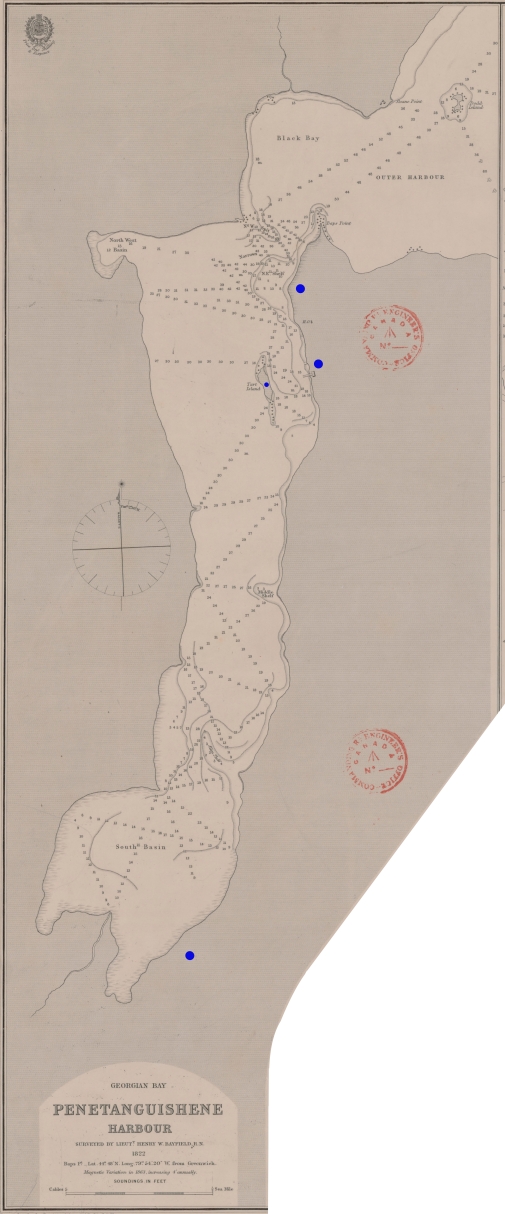
Image 1: Bayfield’s Survey of Penetanguishene Harbour, showing the narrow entrance, the depth, the location of the establishment and the town. The river flowing out of the harbour allowed easy canoe access farther inland.
Before the construction of the establishment the area was well traversed by both First Nations and Europeans. The Wendat had permanent villages in the area during the 17th century when the Europeans arrived. Toanche, the village that Etienne Brule lived in, and Samuel de Champlain visited, is located on the west side of Penetanguishene Bay. Jesuits also visited and lived on the land geographically south of Georgian Bay working to convert the First Nations to their faith. When the Wendat dispersed the Iroquois occupied the area for some time until the Ojibway settled in there. After its initial European discovery, European companies commonly used Penetanguishene and the surrounding bays as fur trading routes. The North West Company even suggested and supported the creation and construction of an Establishment in the area and a road in order to avoid getting close to the United States border during the War of 1812. Therefore, when the British were in need of constructing a permanent naval establishment on the Upper Lakes they chose Penetanguishene Bay.
Discovery Harbour opened its doors in 1973 after being refurbished and reconstructed to look similar to the original establishment that would have been there in the 1820s. The reconstruction is only representative of what it would have looked like, as there were more buildings that also would have changed over time. The original Establishment also would have been farther up the hill where the Waypoint Centre for Mental Health is located today. Two ships, the H.M.S. Bee and the H.M.S. Tecumseh were also constructed based on their original designs and float in front of the dock in the harbour. Before the site was reconstructed and opened an archeological dig had taken place. Professor Wilfrid Jury of the University of Western Ontario, his wife and his students, organized and executed the dig, and completed research reports on what was found. Artifacts were collected and preserved. While only a couple of the buildings are original the Huronia Historical Parks conducted a lot of research before opening to ensure that the reconstruction was as accurate as possible. The buildings are furnished with contemporary artifacts specific to what each officer, seaman, or soldier would have had with him.
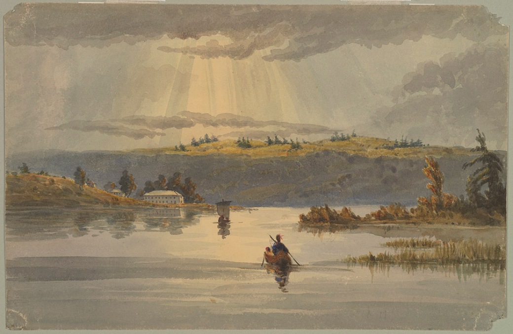
Image 2: Painted by George Russell Dartnell, Surgeon at the Establishment, this painting displays the steepness of the hills around the entrance to the harbour. The painting also shows both a canoe and a ship, possibly representing the people that lived there at that time. In the distance a building that is part of the establishment can also be seen.
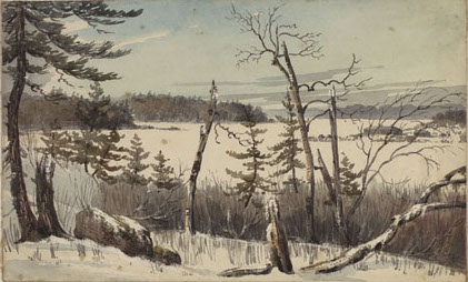
Image 3: Painted by George Russell Dartnell, Surgeon at the Establishment, this painting shows the view from the edge of the bay looking out towards Prince Edward Island (Beausoleil Island). This painting was done directly across from the establishment.
The H.M.S. Tecumseh, which had been sunk to the bottom of the harbour, was brought up and put on display. The Tecumseh is a Topsail Schooner that was one of two stationed at Penetanguishene from 1817-1828 (however, the date that it was decommissioned and sunk varies into the early 1830s). The original was built in Chippewa in 1815 and was meant to be a warship along side its sister ship the H.M.S. Newash, however, both vessels ended up mainly being used as transports. The replica is also an honourary British Royal Navy ship. The H.M.S. Bee is a Gaff Topsail Schooner and was one of three stationed at Penetanguishene from 1817 to 1831 (the other two were the H.M.S. Mosquito, and H.M.S. Wasp). The Bee was used to ferry goods and men between the Nottawasaga and Penetanguishene as well as taking various trips Northwest into the Upper Lakes. The replica is believed to look almost identical to the original.
March 2017
From March 22nd to March 23rd, 2017, Kirsten Greer, Margot Maddison-MacFadyen, Randy Restoule and I travelled to Penetanguishene, Ontario, to visit various locations within the town that have connections to the greater British Empire through the navy, military, and lumber industry, as well as connections to the Dokis First Nation.
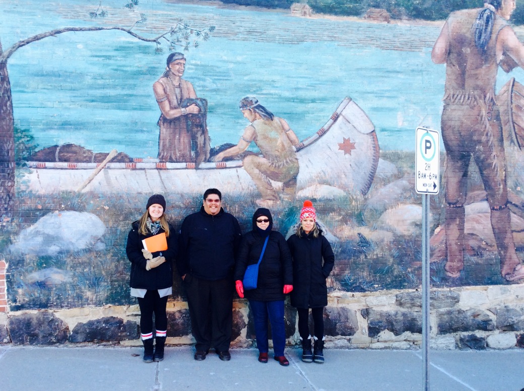
Image 4: Infront of the mural located on the corner of Water Street and Main Street. Sabrina Morrison, Randy Restoule, Margot Maddison- MacFadyen, Kirsten Greer
When we arrived in Penetanguishene we started our visit at the Centennial Museum and Archives that was once the Beck Manufacturing Company Office. The main floor and some of the upstairs is maintained as a Museum but part of the upstairs is set-aside for Public Archives relating to Penetanguishene. The archives hold various books, articles, documents, and plans for Penetanguishene and the surrounding area. The topics range from genealogy, town and population records, as well as some information on personnel from the establishment. Unfortunately, we determined that the Beck Manufacturing Company Archives are not held there and are actually housed at the Simcoe County Archives in Midhurst. After looking through the archives for a couple of hours we began our walking tour of Penetanguishene (the map and locations can be found on a file linked at the beginning of this section). The tour included locations relevant to the establishments, the fur trade and the lumber industry as well as any locations believed to be of relevance to the Dokis First Nation. While we were walking we came across a mural that depicts a group of First Nations arriving with a canoe full of furs. The mural is located on the outside wall of The Green Block Trading Post, which was owned by the Thompson family and was well known around the area for trading fur. It was quite cold so the tour was ended early and we went to a local restaurant to discuss what we had found at the museum/archives and what we had seen on the tour. That evening we all had dinner with Kimberly Monk in Collingwood discusses current and potential research projects.

Image 5: Dinner at Montana’s in Collingwood. Kimberly Monk, Kirsten Greer, Sabrina Morrison, Margot Maddison-MacFadyen, Randy Restoule
At 9am the following morning we all met in Penetanguishene at Discovery Harbour where we met Mike and Larry (Historic Program Coordinators). The site was closed for the season but we had made arrangements so that we could visit while we were in the area. We began the tour of the facility at the Tecumseh Centre, where they have the remains of the original H.M.S. Tecumseh. The Centre also has a lot of information displayed about the personnel, how items were delivered to the establishment, how it was managed, and what happened after it closed. I was able to confirm my belief that there was a Surgeon stationed there before Assistant Surgeon C.C. Todd, Surgeon Tarte, who passed away at the establishment before being there a year. There are also copies of images that were taken, painted and drawn by inhabitants of the establishment and the town that are displayed throughout the building. Some of these images I had already gained access to through various online databases but some of them I had never seen before and Mike and Larry promised to help me identify their locations so I could get copies.
We also viewed various tools and items that are displayed around the ship as well as the in the room adjacent. Some of these items were recovered from the water with the ship and others were recovered from an archeological dig around the establishment. There are also paintings, portraits, surveys, and images displayed in the adjacent room. The images were mainly from the days after the closing of the establishment, depicting how the buildings were used after it closed. Many of the paintings depict daily life and were mostly done by the Hallen family but there are a few from other artists. The write-ups discuss everything from daily military/naval life, hydrographic surveying, Indian Agents, First Nations, and what became of the establishment. The Tecumseth Centre has the most information displayed and written than in any other building on the premises of Discovery Harbour.
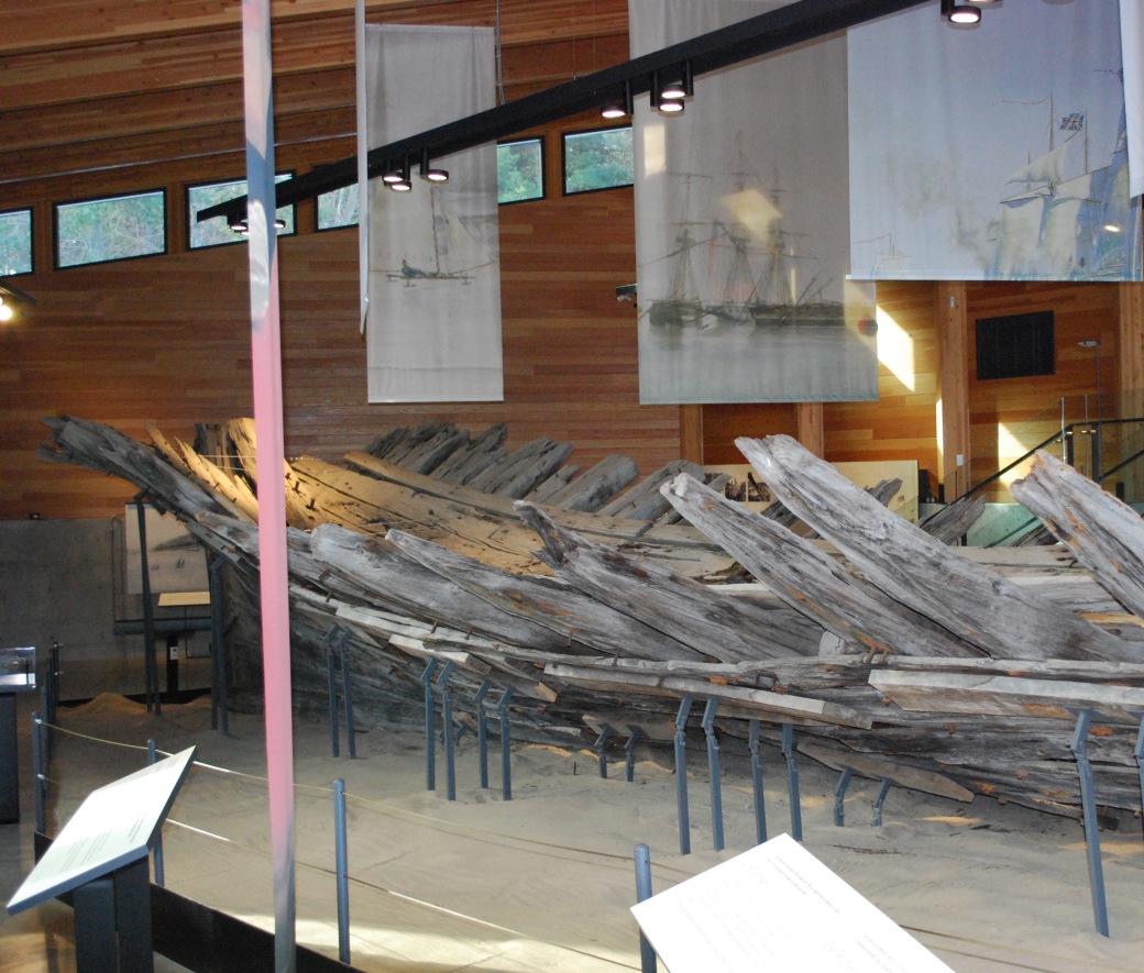
Image 6: Remains of the hull of the H.M.S. Tecumseh now in the Tecumseh Centre at Discovery Harbour.
We then began our walk from the Tecumseh Centre towards the main entrance. Along the way we stopped at the two gravestones located on the grounds; one belonging to a woman who is believed to have been there with her husband, the other is for two soldiers who died on the way to Penetanguishene. Just past the graves is where the reconstructed houses are located. The one we went into was representative of Captain Bayfield quarters while he was based at the Establishment in the 1820s. At this time it was not outfitted with very many props but Mike and Larry told us that when Discovery Harbour is open to the public the cabin is filled with hydrographic tools and charts, as well as other items that he may have had with him in his cabin. A kitchen cabin is also located behind the house and is also outfitted with all the proper items when the establishment is open to visitors. We did not enter the other cabins but they are representative of where the other officers would have lived while stationed there. They were built to the size that archeologists believe these men would have had. Considering this and the props/artifacts, I believe Discovery Harbour presents a realistic depiction of what the inside of the cabins of these men would have looked like.
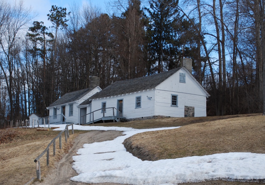
Image 7: Reconstructed houses of where the officers and their families would have lived in the 1820s. Indoors some of them are furnished with contemporary furniture and artifacts.
While we were there we could not go down into the vessels that have been replicated, the H.M.S. Bee and H.M.S. Tecumseh but we could see them from where we were standing. From there we walked back towards the Tecumseh Centre, which is set back behind the Keating house. The Keating house was originally built for Captain James Keating of the Army and has continually been maintained. Keating was at the Military Establishment from 1828 until his death in 1849 and is buried in the local cemetery attached to the St. James-on-the-Lines Church, which he was influential in establishing. Unfortunately we did not have enough time to visit the site. We were also unable to go inside the Keating House at this time. We then continued past these buildings to get to the Officers Barracks that was built in the 1830s. Housed in the building are multiple artifacts that have been discovered or collected by Discovery Harbour over the years. A lot of the artifacts did not come from the establishment but are contemporary and are representative of what would have been there at the time. The building has been updated to suit modern programming and codes but still maintains an historic atmosphere. Facing the outer harbour the building is in a good location to view any vessels coming in or leaving the establishment. As we walked back to where we were parked we discussed including Discovery Harbour in our project and made sure we had all the necessary contact information.
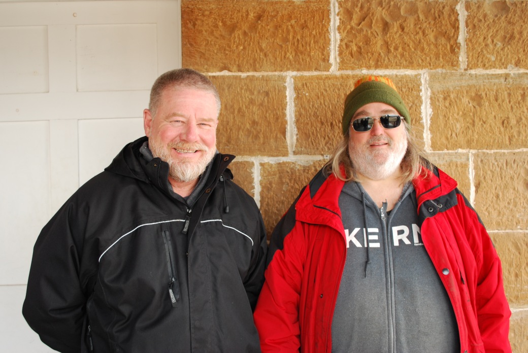
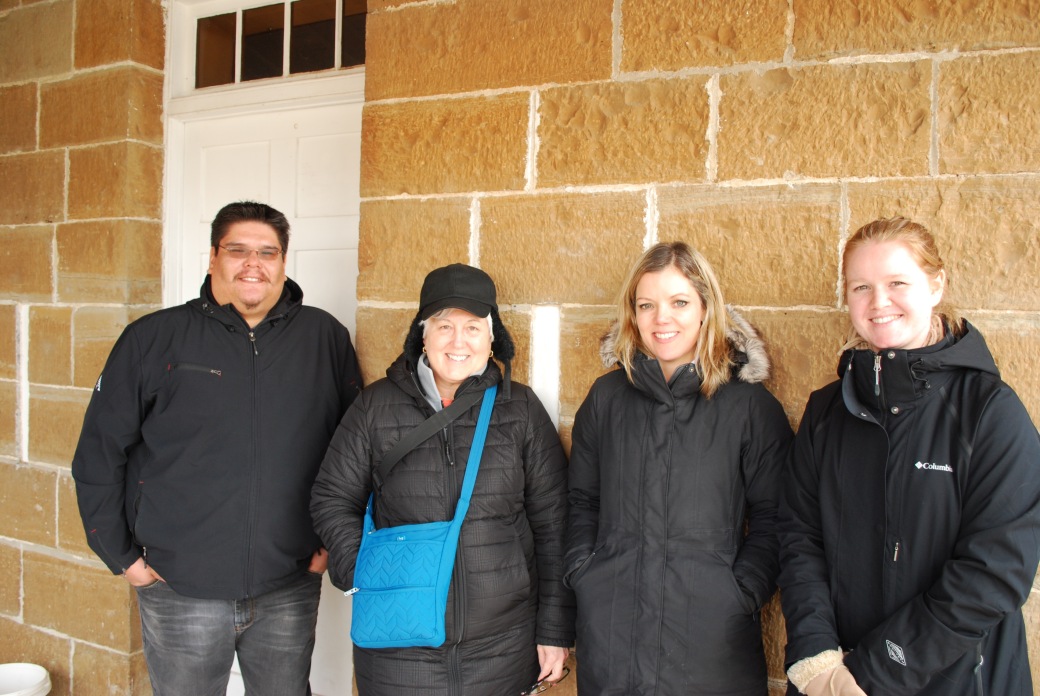
Image 8: Outside of the Officer’s Quarters at Discovery Harbour.
Top: Larry and Mike
Bottom: Randy Restoule, Margot Maddison-MacFadyen, Kirsten Greer, and Sabrina Morrison
After leaving Discovery Harbour we had lunch at Gidley’s Galley, a diner located in Penetanguishene. It was named to represent the history of Gidley Boat Works that was located in Penetanguishene from the 1880s until the Grew Boat Works bought them out in the early 1920s. It is believed that Dokis First Nation previously owned the land where the Gidley Boat Works was located. Every year the Dokis came to trade with Mr. A.A. Thompson and they camped and lived at this location for the duration of their stay. While the owner and workers in the diner did not know any further information about the history behind the name of the restaurant the meals were very good.
From there Kirsten, Margot and I travelled to the Huronia Historical Museum in Midland, Ontario (5-10 minutes from Penetanguishene). The museum covers pre-history to the late 1900s relating to the surrounding areas and the peoples who used to inhabit it. The museum contains a lot interesting pictures, paintings, and artifacts on the areas history. While their displays are fairly small, they are very detailed, discuss a lot of different parts of the history and are full of valuable information for anyone doing research. One of the first sections you see when you first enter the museum is a wall that is full of pictures of the local timber companies and the men who worked there. There is also a lot of general information about the various companies that were around the area. Furthermore, some of the paintings and drawings done by the Hallen family are on display there; most of the pictures are of the Penetanguishene area. We were also able to view the two paintings Margot loaned to the museum of Captain T.G. Anderson and his wife. While at the Museum we were also able to purchase a few different books relating to the history of the area, including the “The St. Lawrence Survey Journals of Captain Henry Wolsey Bayfield”. We then began our drive back to Nipissing University; on our way we discussed direct connections to the current research as well as future research projects – Penetanguishene: The Place of Empire, Trade, and the Dokis.
Continued/Future Research
The trip provided us with a lot of valuable information to use for future research. While at the Centennial Museum we were able to identify the location of the Beck Manufacturing Company Archives. The Company is believed to have connections throughout at the British Empire, as lumber produced by the company was used to construct various crates for goods to be shipped around the world from the Penetanguishene and surrounding area. The Centennial Museum also had Fire Plan maps from 1880, which identifies a three-cornered plot of land on the water that was owned by H.E. Gidley. We have found other documents that state the Dokis First Nation once owned a three-cornered plot of land on the water that was later owned by the Gidley family, therefore the map supports our previous knowledge. The Centennial Museum had a lot of little bits of information about the town and its people rather than a lot on one specific topic.
When Discovery Harbour was being constructed HHP collected documents from various archives and books that had any relation or mention of the Establishment and town. They also collected documentation of what was there before the Establishment and what happened to the buildings and town afterwards. Almost all of these documents are now housed in the Henry Wolsey Bayfield Room in the Penetanguishene Public Library. Some are also housed in the archive room at Sainte-Marie-Among-the-Hurons. These documents will likely provide more information and connections to the British Empire and potentially the Dokis First Nation.
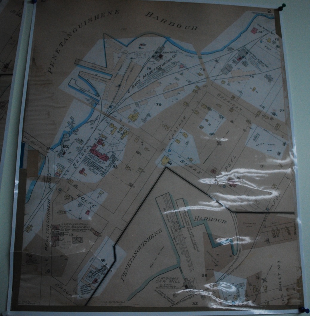
Image 9: Fire Plan of Penetanguishene from 1880 held in the Centennial Museum in Penetanguishene
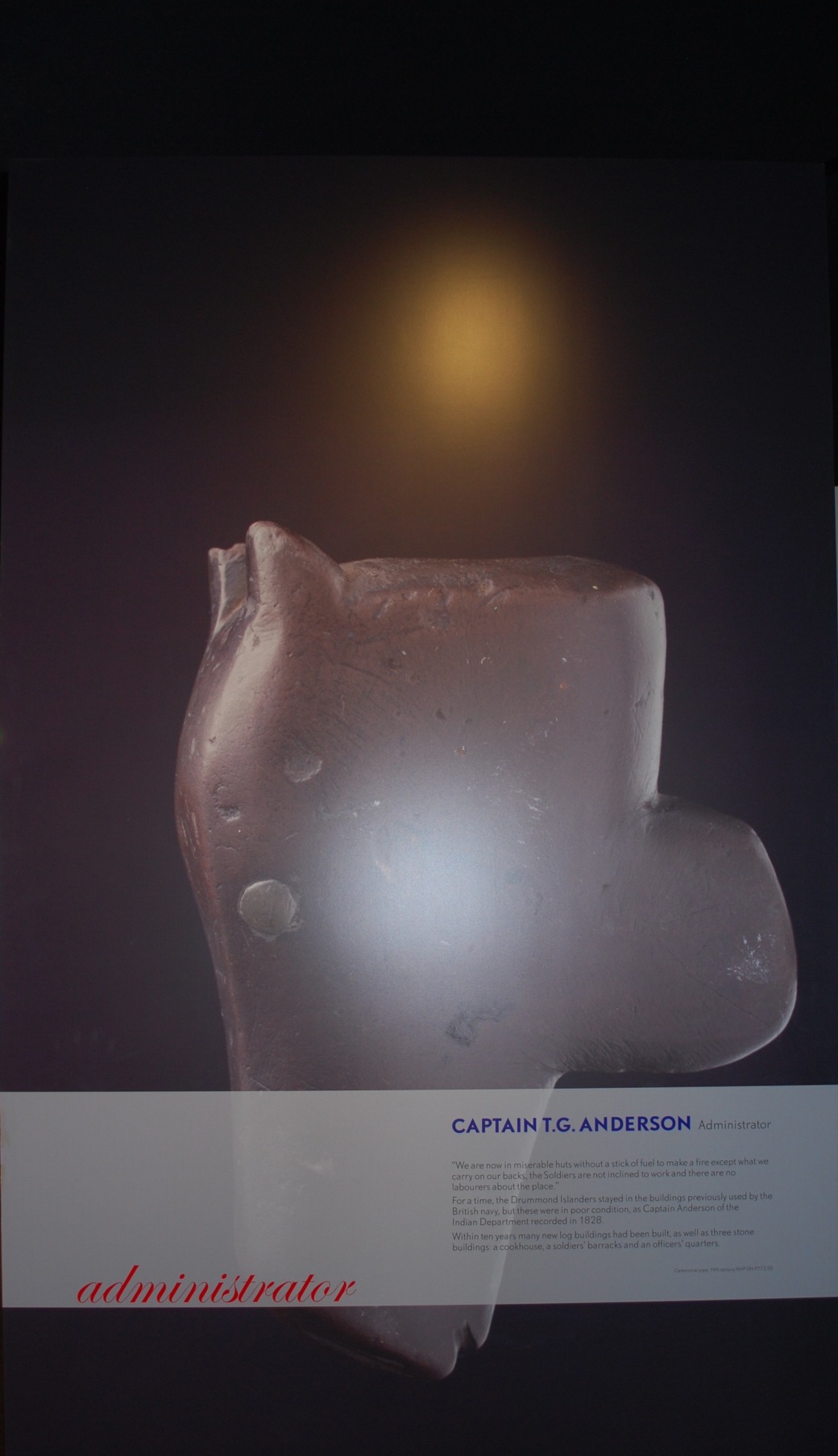
Image 10: A display for Captain T.G. Anderson at Discovery Harbour
