Overview of Posts

Blog Posts

Blog 1: “Yes, it’s true, a dendrochronologist can be friends with a post-structuralist”
By: Kirsten Greer, Geography & History, Nipissing University

Blog 2: The Importance of Reconnaissance Trips in Research Projects – A Photo Essay
By: Kirsten Greer

Blog 3: Update On Andrew Smith’s activities for the Timber Project
By: Andrew Smith

Blog 4: Histories of Enslavement in the Maritime Atlantic
By: Margot Maddison-MacFadyen

Blog 5: Team Canada’s Bermuda Research Trip – May 2015
By: Kirsten Greer

Blog 6: Calvert on Bermuda’s Changing Energy Landscape
By: Kirby Calvert

Blog 7: Maddison-MacFadyen on Historical Timber Ponds in the North Atlantic
By: Margot Maddison-MacFadyen

Blog 8: Geotagging Images Then and Now
By: Megan Prescott, Kirsten Greer, and Kirby Calvert

Blog 9: Science and Art of HGIS
By: Megan Prescott (in collaboration with Kirby Calvert and Kirsten Greer)

Blog 10: Dendrochronology and Stable Isotope Research at Nipissing University
By: Laurel Ann Muldoon

Blog 11: Empire, Trees and Climate at the CAG in Halifax May/June 2016
By: Kirsten Greer

Blog #12: Empowering HGIS Research at ESRI Canada User Conference October 2016
By: Megan Prescott

Blog #13: A New Project Partner and The History of Bermuda’s Climate Records
By: Kirsten Greer and Laurel Muldoon

Blog #14: Empire Trees and Climate in Chicago – Part 1 of 3
By: Kirsten Greer

Blog #15: “Echoes of Bermuda”: Listening to past, present, and future soundscapes
By: Katie Hemsworth

Research Profiles

Research Profile #1: Adam Csank, Paleoclimatologist & Dendrochronologist

Research Profile #2: Kirby Calvert, Energy Geographer

Research Profile #3: Kimberly Monk, Maritime Archaeologist

Research Profile #4: Katie Hemsworth, Cultural Geographer

Research Profile #5: Margôt Maddison-MacFadyen, Interdisciplinarian & Historical Geographer

Research Trajectories

Research Trajectories #1

Research Trajectory #2: Timbers & PEI’S Province House
By: Margot Maddison-MacFadyen

Research Trajectory #3: Robert S. Platt, Bermuda, and the “Region”
By: Kirsten Greer

Research Trajectory #4: The Chicago World Fair, Franz Boas, and the Dokis First Nation
By: Dr. Kirsten Greer and Randy Restoule

Research Trajectory #5: The Natural History Collections of Bermuda
By: Kirsten Greer

Research Trajectory #6: Penetanguishene PART 1
By: Sabrina Morrison

Research Trajectory #6: Penetanguishene PART 2 – Gendering Imperial Infrastructure
By: Emily Fachnie

Research Trajectory #6: Penetanguishene PART 2 – Gendering Imperial Infrastructure

The following post is Part 2 of a series of pieces on preliminary research and activities involving the British Naval & Military Establishment at Penetanguishene, Ontario (click here for Part 1 by Sabrina Morrison).  Our aim is to broaden our geographical scope from Bermuda  and the West Indies to British North America’s “Middle Country”.  These sites were connected by the Royal Navy’s North America and West Indies Station in the nineteenth century.

Today’s post is by another CRC Research Assistant, Emily Fachnie (MA in History at Nipissing University), who is conducting research on the role of women at the Naval & Military Establishment.


Research at the Penetanguishene Library

Documents and books relating to the history of Penetanguishene, are in part located in the Henry Wolsey Bayfield Room at the Penetanguishene Library. One of the first tasks in researching the connections between Penetanguishene and the British Empire, as well as the Dokis First Nation, is to go through the books and documents searching for references and information in relation to the various research trajectories (Dokis First Nation, women’s experiences, land and hydrographic surveying, the Naval and Military Establishments, elements of the non-human world, Atlantic connections with Bermuda). The books range in date and topic, type and form, with some written during the nineteenth century, while others feature collections of essays written throughout the twentieth century.

1

Figure 1. Image of some of the books, reports and documents to go through. It is fascinating – and easy to get lost! – going through and seeing what bits of information are waiting to be found or letters read. Majority are books, but there are also reports, photocopied book excerpts, as well as journals featuring articles. Topics include archaeology and the Fur Trade, the War of 1812, British Naval history, and local histories of various settlements in Upper Canada. (Image by Emily Fachnie).

Many include travel accounts which describe the Penetanguishene settlement and Military/Naval Establishments as travellers often stayed at Penetanguishene on their way through Upper Canada. Others discuss people connected to Penetanguishene, providing more information for following and understanding the extent of networks in British North America. Reports and accounts of Penetanguishene history at times also reference specific books and articles for suggested reading or as references, leading to another piece of scholarship to locate and contribute to our research. For example, while reading through an excerpt of a book, it contained a chapter titled “The Early History of Muskoka” which referenced an article by Alexander Sherriff from 1831 – “Topographical Notices of the Country lying between the mouth of the Rideau and Penetanguishene” – and a report by two military personnel. This report was included in the Appendix to the Journals of the House of Assembly of Upper Canada for 1836-1837 and consisted of their explorations near Lake Huron with Penetanguishene as their base. There was a surveyor and guides from Penetanguishene who also accompanied them (Wallace, 1954). While this literature may be featured in books or journals we have not gone through yet in the Bayfield Room, they are important to note for future reference.

2.jpg

Figure 2. The Bay of Penetanguishene, 1837. Pencil on paper. By Anna Brownell Jameson (1794-1860). Jameson travelled throughout Upper Canada in the 1830s, writing an account of her travels: Winter Studies and Summer Rambles published in 1838 (Fowler, 1982). (Image retrieved from the Toronto Public Library’s Capturing Canada).

In addition to references to Penetanguishene, the Naval/Military Establishments, or connections to Dokis First Nation, while reading through the many pages I also note people named in relation to these topics. In the same book with the chapter on Muskoka, the author also makes reference to George Gordon, a trader who lived in Penetanguishene (Wallace, 1954). His written accounts – which may be among the shelves of the Bayfield Room – will perhaps provide information on the people and events of Penetanguishene. Other people I also note are John Graves Simcoe, Henry Bayfield, as well as members of the Hallen family and the Barrie family.

My particular research interest is women’s roles and experiences in British North America, in relation to Penetanguishene, the Naval Establishment, and hydrographic surveying. Many of the British women who travelled and/or settled in Upper Canada with their husbands and fathers wrote or drew aspects of their environment and travels. The accounts collected at the Penetanguishene Library are in general, the views of white British women’s experiences. However, their narratives and visual depictions provide valuable information on the people and places of nineteenth century Upper Canada, as well as contributing to understanding networks of the British Empire.

3

Figure 3. Penetanguishe Bay 1844 by Mary (Hallen) Gilmour. Mary (1819-1908) was the daughter of George Hallen (1794-1882) and Sarah Williams (1794-1864). George Hallen and his family moved from England to British North America in 1835. Eventually the family settled in Penetanguishene with George Hallen as the chaplain of the Naval Establishment. Mary was one of eleven children. Mary, her father and her sisters – Sarah (1818-1888) and Eleanora (1823-1846) – wrote diaries throughout their lives, including when living at Penetanguishene. The sisters, along with their brother Edgar (1824-1911), also painted and sketched (Murdoch and Rowan, 1982). A copy of Eleanora’s diary and some of the Hallen children’s drawings are at the Penetanguishene library. (Image: Library and Archives Canada. Retrieved from “Down Lake Huron”).

Eliza Roberta Barrie (1823-1874)

Eliza Roberta Barrie was born on 6 July 1823 at Kingston in Upper Canada, to Sir Robert Barrie (1774-1841) and Julia Wharton Ingilby. She was predominately referred to as Roberta by her family. She was one of six children, including her older sisters Julia, Dorothea, an older brother William, as well a younger sister, Georgy. The family also adopted Lizzie MacRobb when she was eight (Brock, 1968). In 1825, the Barrie family journeyed to England, although eventually returned to Kingston in 1830. In 1834, the family left Kingston for England again, this time as a result of the discontinuation of the Naval Post (“Sir Robert Barrie”).

Eliza Barrie’s father was commissioner of the Kingston dockyard from 1819 until 1827 when he became the commodore. In 1834 the Kingston Naval Establishment was shut down and the Barrie family moved back to England. One of the tasks Barrie was focused on during his time as commissioner was the hydrographic surveying of the St. Lawerence River and the Great Lakes (“Sir Robert Barrie”). From June to July 1833 he went on a tour of the Lakes with his wife and three of his children (Julia, Roberta and their brother) aboard the Bull Frog (Brock, 1968).

During this tour, 10-year-old Eliza Barrie began her diary. While a portion of the diary describes the health and wellbeing of her family and herself, it also describes the places they passed or landed, including the Welland Canal, St. Joseph’s Island and Point Pelée. Eliza also provides information on rocks, such as pudding stones, as well as fruits and flowers, including roses and a ‘Twin Flower,’ at various locations throughout her journey. In addition, various people are also named in her journal, and Indigenous peoples frequent her accounts (Barrie, 1933).

4

Figure 4. A copy of the title page to Eliza Barrie’s diary. (Image by Emily Fachnie, courtesy of the Penetanguishene Library).

Among other settlements, there is also a description of Penetanguishene, which Eliza describes as “beautiful being situated on a bank sloping to the water.” She continues: “The Harbour is said to be like Windamere but as I never saw Windamere I cannot tell. There is farther in the Harbour another sort of village which they call The Town with 2 shops there but is by no means so pretty as the village” (Barrie, 61).

5

Figure 5. A copy of the page from Eliza Barrie’s diary featuring a description of Penetanguishene. (Image by Emily Fachnie, courtesy of the Penetanguishene Library).


Hydrographic Surveying in Upper Canada

The other element of this research is related to hydrographic surveying. Numerous books, reports and letters located in the Bayfield Room relate to surveying during the eighteenth, nineteenth and twentieth centuries. The documents record various projects, including those in the Great Lakes region. Many people played a part in mapping and surveying the land and water of Upper Canada, and this research also considers the extent and ways women were involved.

One of these women was Amelia Harris (1798-1882). She was born to Samuel Ryerse who was a United Empire Loyalist, and Sarah Underhill. Amelia moved to Kingston when she married John Harris (1782-1850) on 28 June 1815. He was a Master in the Navy but became a hydrographer under the leadership of Captain William Fitz William Owen. Amelia and John Harris lived at the Hydrographer’s House in Kingston, and while Amelia Harris had domestic responsibilities, she also assisted John Harris and the other surveyors by drawing or copying documents. An island in the St. Lawrence River was even named after her, and many letters were exchanged between members of the “Hydrographers Group” over the following decades (Harris and Harris, 1994; “Ryerse, Amelia (Harris)”). In one letter from 1816, John Harris asks his wife to draw a depiction of the Thousand Islands and describes her as “one of the assistants” (quoted in Harris and Harris, 1994).

I also researched women and surveying by reading the reports and accounts of men who surveyed throughout the nineteenth century. This included Henry W. Bayfield (1795-1885), who married Fanny Wright (1813-1891) in 1838 (“Wright, Fanny Amelia”). Bayfield played a large role in the hydrographic surveying of various bodies of water in Upper Canada, including Lake Superior and the St. Lawerence River. He also contributed to geological research by collecting samples of rocks and minerals (“Bayfield, Henry Wolsey”). I learned through research at the Penetanguishene Library that his wife painted. This prompted a search into whether she had helped him sketch maps or record the environment of Upper Canada through paintings. Although so far my investigations have revealed she generally painted Quebec and Charlottetown, she may have contributed to his surveying in those regions, rather than of the Great Lakes and Upper Canada (“Wright, Fanny Amelia”).

6

Figure 6. The King’s Wharf. Fanny Amelia Bayfield, Fanny Amelia Bayfield fonds. Library and Archives Canada, accession number 1989-287-12, C-002671. This painting captures a scene of Quebec City in the nineteenth century. (Image retrieved from Carleton University’s Heritage Passages).


What’s Next?

Many stories of the roles and experiences of British women and girls in Upper Canada during the nineteenth century remain unexplored and untold. Scholarship on Elizabeth Posthuma Simcoe or Catherine Parr Strickland, provide examples of previous research into valuable accounts of women’s experiences in and interpretations of British North America. Continuing to delve into accounts and records in relation to hydrographic surveying of the Great Lakes, may provide information on women involved in mapping or painting. This also involves locating the drawing of the Thousands Islands by Amelia Harris, mentioned in the 1816 letter.

Furthermore, Eliza Roberta Barrie’s narrative offers insight into social networks and the natural world on and near the Great Lakes. In researching Eliza Roberta Barrie and her accounts of the cruise, I learned that her sister and mother may also have written accounts of their journey and perhaps also wrote about Penetanguishene. This will be one of the next elements to look into within this research, in addition to exploring more of the themes reflected in Eliza Barrie’s diary. These accounts provide case studies of people’s lived experiences and the world around them – stories which contribute to our understanding of the past.


References

Barrie, Roberta. “Journal of Barrie Family Cruise of the Great Lakes in Schooner Bull Frog.”      June- July 1833. Transcript.

Brock, Thomas L. “Commodore Robert Barrie and his Family in Kingston, 1819- 1834.” Historic Kingston 23 (1968): 1- 18.

Brock, Thomas L. “Sir Robert Barrie.” In Dictionary of Canadian Biography, vol. 7. University of  Toronto/Université Laval, 2003. Accessed 6 June 2017, http://www.biographi.ca/en/bio/barrie_robert_7E.html.

Carleton University. “Heritage Passages: Recruitment: King’s Wharf ca. 1827-1841, Quebec City, Quebec.” Virtual Museum. Accessed 7 June 2018, http://www.passageshistoriques-heritagepassages.ca/ang-eng/ouvriers-labour/le_recrutement-recruitement/le_quai_du_roi_vers_1827_1841_quebec-kings_wharf_ca_1827_1841_quebec_city

Doucette, Joanne. “Down Lake Huron.” Accessed 8 June 2018, https://liatris52.wordpress.com/down-lake-huron/.

Fowler, Marian. Embroidered Tent: Five Gentlewomen in Early Canada. Toronto: House of Anansi Press, 1982.

Harris, Robin S. and Terry G. Harris, eds. The Eldon House Diaries: Five Women’s Views of the  19th Century. Toronto: The Champlain Society, 1994.

Harris, Robin S. “Ryerse, Amelia (Harris).” In Dictionary of Canadian Biography, vol 11.      University of Toronto/Université Laval, 2003. Accessed 6 June 2018, http://www.biographi.ca/en/bio/ryerse_amelia_11E.html.

McKenzie, Ruth. “Wright, Fanny Amelia.” In Dictionary of Canadian Biography, vol. 12. University of Toronto/Université Laval, 2003. Accessed 7 June 2018, http://www.biographi.ca/en/bio/wright_fanny_amelia_12E.html.

McKenzie, Ruth. “Bayfield, Henry Wolsey.” In Dictionary of Canadian Biography, vol. 11.    University of Toronto/Université Laval, 2003. Accessed 7 June 2018, http://www.biographi.ca/en/bio/bayfield_henry_wolsey_11E.html.

Murdoch, Su and Michael Rowan. “‘The Wish to Take a Sketch of It’: George Hallen and Family.” In East Georgian Bay Historical Journal: Documenting the heritage of the District of Muskoka, the District of Parry Sound and the County of Simcoe, Volume II. Elmvale: East Georgian Bay Historical Foundation, 1982.

Toronto Public Library. “The Bay of Penetanguishene.” Capturing Canada on Paper and Canvas. Accessed 6 June 2018, http://static.torontopubliclibrary.ca/ve/capturing_canada/966-6L_sketches_43.html.

Wallace, Stewart W. The Pedlars from Quebec and Other Papers on the Nor’ Westers. Toronto: Ryerson Press, 1954.


Research Trajectory #6: Penetanguishene PART 1

The following post is one of several pieces on preliminary research and activities involving the British Naval & Military Establishment at Penetanguishene, Ontario.  Our aim is to broaden our geographical scope from Bermuda  and the West Indies to British North America’s “Middle Country”.  These sites were connected by the Royal Navy’s North America and West Indies Station in the nineteenth century.

Last spring, team members of Empire Trees Climate visited Penetanguishene to map future research directions.  Part 1 was written by Sabrina Morrison, an undergraduate researcher from Nipissing University.  Sabrina is pursuing her MA in Geography at King’s College in London, UK, this Fall.

History behind Discovery Harbour

Discovery Harbour is the reconstruction of the Naval and Military establishment that was located in that location 200 years ago. Penetanguishene, described as the Ultima Thule of Empire by Sir Richard Henry Bonnycastle, was the farthest inland Naval outpost in the British Empire. The British maintained an outpost at this location for over 40 years either as a Naval or Military establishment. The harbour was well suited for a naval establishment and was purchased by Lieutenant-Governor John Graves Simcoe in 1798, however nothing was built at this location until 1817. Penetanguishene was initially chosen as a location for the Naval Establishment for multiple reasons. It was a deep harbour, with a narrow entrance and steep hills that could be defended easily; the harbour was and is still surrounded by vast forests with various species of trees, which were good for building vessels that could sail on the Upper Lakes. From 1817 to 1828 it served strictly as a Naval Establishment. In 1828 when the Military outpost on Drummond Island was ceded to the Americans, its British occupants were removed to Penetanguishene, making the location a Military and Naval Establishment. In 1834 the Royal Navy officially removed all personnel from Penetanguishene leaving it as strictly a Military Establishment until its closure in 1854.

Image 1(1)

Image 1: Bayfield’s Survey of Penetanguishene Harbour, showing the narrow entrance, the depth, the location of the establishment and the town. The river flowing out of the harbour allowed easy canoe access farther inland.

Before the construction of the establishment the area was well traversed by both First Nations and Europeans. The Wendat had permanent villages in the area during the 17th century when the Europeans arrived. Toanche, the village that Etienne Brule lived in, and Samuel de Champlain visited, is located on the west side of Penetanguishene Bay. Jesuits also visited and lived on the land geographically south of Georgian Bay working to convert the First Nations to their faith. When the Wendat dispersed the Iroquois occupied the area for some time until the Ojibway settled in there. After its initial European discovery, European companies commonly used Penetanguishene and the surrounding bays as fur trading routes. The North West Company even suggested and supported the creation and construction of an Establishment in the area and a road in order to avoid getting close to the United States border during the War of 1812. Therefore, when the British were in need of constructing a permanent naval establishment on the Upper Lakes they chose Penetanguishene Bay.
Discovery Harbour opened its doors in 1973 after being refurbished and reconstructed to look similar to the original establishment that would have been there in the 1820s. The reconstruction is only representative of what it would have looked like, as there were more buildings that also would have changed over time. The original Establishment also would have been farther up the hill where the Waypoint Centre for Mental Health is located today. Two ships, the H.M.S. Bee and the H.M.S. Tecumseh were also constructed based on their original designs and float in front of the dock in the harbour. Before the site was reconstructed and opened an archeological dig had taken place. Professor Wilfrid Jury of the University of Western Ontario, his wife and his students, organized and executed the dig, and completed research reports on what was found. Artifacts were collected and preserved. While only a couple of the buildings are original the Huronia Historical Parks conducted a lot of research before opening to ensure that the reconstruction was as accurate as possible. The buildings are furnished with contemporary artifacts specific to what each officer, seaman, or soldier would have had with him.


Image 2

Image 2: Painted by George Russell Dartnell, Surgeon at the Establishment, this painting displays the steepness of the hills around the entrance to the harbour. The painting also shows both a canoe and a ship, possibly representing the people that lived there at that time. In the distance a building that is part of the establishment can also be seen.


Image 3

Image 3: Painted by George Russell Dartnell, Surgeon at the Establishment, this painting shows the view from the edge of the bay looking out towards Prince Edward Island (Beausoleil Island). This painting was done directly across from the establishment.
The H.M.S. Tecumseh, which had been sunk to the bottom of the harbour, was brought up and put on display. The Tecumseh is a Topsail Schooner that was one of two stationed at Penetanguishene from 1817-1828 (however, the date that it was decommissioned and sunk varies into the early 1830s). The original was built in Chippewa in 1815 and was meant to be a warship along side its sister ship the H.M.S. Newash, however, both vessels ended up mainly being used as transports. The replica is also an honourary British Royal Navy ship. The H.M.S. Bee is a Gaff Topsail Schooner and was one of three stationed at Penetanguishene from 1817 to 1831 (the other two were the H.M.S. Mosquito, and H.M.S. Wasp). The Bee was used to ferry goods and men between the Nottawasaga and Penetanguishene as well as taking various trips Northwest into the Upper Lakes. The replica is believed to look almost identical to the original.
March 2017
From March 22nd to March 23rd, 2017, Kirsten Greer, Margot Maddison-MacFadyen, Randy Restoule and I travelled to Penetanguishene, Ontario, to visit various locations within the town that have connections to the greater British Empire through the navy, military, and lumber industry, as well as connections to the Dokis First Nation.

Full Penetanguishene Visit

Image 4

Image 4: Infront of the mural located on the corner of Water Street and Main Street. Sabrina Morrison, Randy Restoule, Margot Maddison- MacFadyen, Kirsten Greer
When we arrived in Penetanguishene we started our visit at the Centennial Museum and Archives that was once the Beck Manufacturing Company Office. The main floor and some of the upstairs is maintained as a Museum but part of the upstairs is set-aside for Public Archives relating to Penetanguishene. The archives hold various books, articles, documents, and plans for Penetanguishene and the surrounding area. The topics range from genealogy, town and population records, as well as some information on personnel from the establishment. Unfortunately, we determined that the Beck Manufacturing Company Archives are not held there and are actually housed at the Simcoe County Archives in Midhurst. After looking through the archives for a couple of hours we began our walking tour of Penetanguishene (the map and locations can be found on a file linked at the beginning of this section). The tour included locations relevant to the establishments, the fur trade and the lumber industry as well as any locations believed to be of relevance to the Dokis First Nation. While we were walking we came across a mural that depicts a group of First Nations arriving with a canoe full of furs. The mural is located on the outside wall of The Green Block Trading Post, which was owned by the Thompson family and was well known around the area for trading fur. It was quite cold so the tour was ended early and we went to a local restaurant to discuss what we had found at the museum/archives and what we had seen on the tour. That evening we all had dinner with Kimberly Monk in Collingwood discusses current and potential research projects.

Image 5: Dinner at Montana’s in Collingwood. Kimberly Monk, Kirsten Greer, Sabrina Morrison, Margot Maddison-MacFadyen, Randy Restoule
At 9am the following morning we all met in Penetanguishene at Discovery Harbour where we met Mike and Larry (Historic Program Coordinators). The site was closed for the season but we had made arrangements so that we could visit while we were in the area. We began the tour of the facility at the Tecumseh Centre, where they have the remains of the original H.M.S. Tecumseh. The Centre also has a lot of information displayed about the personnel, how items were delivered to the establishment, how it was managed, and what happened after it closed. I was able to confirm my belief that there was a Surgeon stationed there before Assistant Surgeon C.C. Todd, Surgeon Tarte, who passed away at the establishment before being there a year. There are also copies of images that were taken, painted and drawn by inhabitants of the establishment and the town that are displayed throughout the building. Some of these images I had already gained access to through various online databases but some of them I had never seen before and Mike and Larry promised to help me identify their locations so I could get copies.

We also viewed various tools and items that are displayed around the ship as well as the in the room adjacent. Some of these items were recovered from the water with the ship and others were recovered from an archeological dig around the establishment. There are also paintings, portraits, surveys, and images displayed in the adjacent room. The images were mainly from the days after the closing of the establishment, depicting how the buildings were used after it closed. Many of the paintings depict daily life and were mostly done by the Hallen family but there are a few from other artists. The write-ups discuss everything from daily military/naval life, hydrographic surveying, Indian Agents, First Nations, and what became of the establishment. The Tecumseth Centre has the most information displayed and written than in any other building on the premises of Discovery Harbour.

Image 6

Image 6: Remains of the hull of the H.M.S. Tecumseh now in the Tecumseh Centre at Discovery Harbour.
We then began our walk from the Tecumseh Centre towards the main entrance. Along the way we stopped at the two gravestones located on the grounds; one belonging to a woman who is believed to have been there with her husband, the other is for two soldiers who died on the way to Penetanguishene. Just past the graves is where the reconstructed houses are located. The one we went into was representative of Captain Bayfield quarters while he was based at the Establishment in the 1820s. At this time it was not outfitted with very many props but Mike and Larry told us that when Discovery Harbour is open to the public the cabin is filled with hydrographic tools and charts, as well as other items that he may have had with him in his cabin. A kitchen cabin is also located behind the house and is also outfitted with all the proper items when the establishment is open to visitors. We did not enter the other cabins but they are representative of where the other officers would have lived while stationed there. They were built to the size that archeologists believe these men would have had. Considering this and the props/artifacts, I believe Discovery Harbour presents a realistic depiction of what the inside of the cabins of these men would have looked like.

Image 7

Image 7: Reconstructed houses of where the officers and their families would have lived in the 1820s. Indoors some of them are furnished with contemporary furniture and artifacts.

While we were there we could not go down into the vessels that have been replicated, the H.M.S. Bee and H.M.S. Tecumseh but we could see them from where we were standing. From there we walked back towards the Tecumseh Centre, which is set back behind the Keating house. The Keating house was originally built for Captain James Keating of the Army and has continually been maintained. Keating was at the Military Establishment from 1828 until his death in 1849 and is buried in the local cemetery attached to the St. James-on-the-Lines Church, which he was influential in establishing. Unfortunately we did not have enough time to visit the site. We were also unable to go inside the Keating House at this time. We then continued past these buildings to get to the Officers Barracks that was built in the 1830s. Housed in the building are multiple artifacts that have been discovered or collected by Discovery Harbour over the years. A lot of the artifacts did not come from the establishment but are contemporary and are representative of what would have been there at the time. The building has been updated to suit modern programming and codes but still maintains an historic atmosphere. Facing the outer harbour the building is in a good location to view any vessels coming in or leaving the establishment. As we walked back to where we were parked we discussed including Discovery Harbour in our project and made sure we had all the necessary contact information.

Image 8a

Image 8b

Image 8: Outside of the Officer’s Quarters at Discovery Harbour.
Top: Larry and Mike
Bottom: Randy Restoule, Margot Maddison-MacFadyen, Kirsten Greer, and Sabrina Morrison

After leaving Discovery Harbour we had lunch at Gidley’s Galley, a diner located in Penetanguishene. It was named to represent the history of Gidley Boat Works that was located in Penetanguishene from the 1880s until the Grew Boat Works bought them out in the early 1920s. It is believed that Dokis First Nation previously owned the land where the Gidley Boat Works was located. Every year the Dokis came to trade with Mr. A.A. Thompson and they camped and lived at this location for the duration of their stay. While the owner and workers in the diner did not know any further information about the history behind the name of the restaurant the meals were very good.

From there Kirsten, Margot and I travelled to the Huronia Historical Museum in Midland, Ontario (5-10 minutes from Penetanguishene). The museum covers pre-history to the late 1900s relating to the surrounding areas and the peoples who used to inhabit it. The museum contains a lot interesting pictures, paintings, and artifacts on the areas history. While their displays are fairly small, they are very detailed, discuss a lot of different parts of the history and are full of valuable information for anyone doing research. One of the first sections you see when you first enter the museum is a wall that is full of pictures of the local timber companies and the men who worked there. There is also a lot of general information about the various companies that were around the area. Furthermore, some of the paintings and drawings done by the Hallen family are on display there; most of the pictures are of the Penetanguishene area. We were also able to view the two paintings Margot loaned to the museum of Captain T.G. Anderson and his wife. While at the Museum we were also able to purchase a few different books relating to the history of the area, including the “The St. Lawrence Survey Journals of Captain Henry Wolsey Bayfield”. We then began our drive back to Nipissing University; on our way we discussed direct connections to the current research as well as future research projects – Penetanguishene: The Place of Empire, Trade, and the Dokis.

Continued/Future Research

The trip provided us with a lot of valuable information to use for future research. While at the Centennial Museum we were able to identify the location of the Beck Manufacturing Company Archives. The Company is believed to have connections throughout at the British Empire, as lumber produced by the company was used to construct various crates for goods to be shipped around the world from the Penetanguishene and surrounding area. The Centennial Museum also had Fire Plan maps from 1880, which identifies a three-cornered plot of land on the water that was owned by H.E. Gidley. We have found other documents that state the Dokis First Nation once owned a three-cornered plot of land on the water that was later owned by the Gidley family, therefore the map supports our previous knowledge. The Centennial Museum had a lot of little bits of information about the town and its people rather than a lot on one specific topic.

When Discovery Harbour was being constructed HHP collected documents from various archives and books that had any relation or mention of the Establishment and town. They also collected documentation of what was there before the Establishment and what happened to the buildings and town afterwards. Almost all of these documents are now housed in the Henry Wolsey Bayfield Room in the Penetanguishene Public Library. Some are also housed in the archive room at Sainte-Marie-Among-the-Hurons. These documents will likely provide more information and connections to the British Empire and potentially the Dokis First Nation.

Image 9.jpg

Image 9: Fire Plan of Penetanguishene from 1880 held in the Centennial Museum in Penetanguishene

Image 10

Image 10: A display for Captain T.G. Anderson at Discovery Harbour

2018 AAG HGSG STUDENT PAPER AWARD COMPETITION

CALL FOR PAPERS & PROPOSALS

Kirsten Greer, HGSG Chair

HGSG STUDENT RESEARCH AWARDS

Student members of the Historical Geography Specialty Group (HGSG) are invited to submit proposals for the HGSG Student Research Award. The specialty group will grant two prizes in 208. The awards will be $400 for the Carville Earle Award recognizing research at the Ph.D. level, and $200 for the Terry G. Jordan-Bychkov Award supporting Master’s level research. Students can win each award only once.

The Carville Earle Award ($400) recognizes research at the PhD-level. To apply, students must submit a two-page research proposal that gives their research question and explains how archival work and/or fieldwork is necessary to complete their project. The research proposal must also specify the archives and/or the field research site that will be utilized. A budget of estimated expenses and a letter of support from the student’s major advisor must accompany the research proposal. The award may be used for travel or other related research expenses. This award is only open to student members of the Historical Geography Specialty Group.

Terry G. Jordan-Bychkov Award ($200) recognizes Master’s level research.  To apply, students must submit a two-page research proposal that gives their research question and explains how archival work and/or fieldwork is necessary to complete their project. The research proposal must also specify the archives and/or the field research site that will be utilized. A budget of estimated expenses and a letter of support from the student’s major advisor must accompany the research proposal. The award may be used for travel or other related research expenses. This award is only open to student members of the Historical Geography Specialty Group.

Please submit your two-page proposal with budget via e-mail by Monday, March 26th, 2018, to Dean Bond, Geography, Loughborough University (D.W.Bond@lboro.ac.uk) and Margot Maddison MacFadyen, Geography & History, Nipissing University (margotm@nipissingu.ca).

PAPERS

The Historical Geography Specialty Group (HGSG) of the AAG will sponsor two student paper award competitions in 2017-2018:

Ralph Brown Award – for papers written by Master’s-level students, and Andrew Hill Clark Award – for papers written at the Ph.D. level.

Each award carries with it a $150 first prize.  Second prizes of lesser amounts may be awarded at the discretion of the competition judges.  In evaluating the papers, preference will be given to those based on primary sources of information rather than literature reviews.


Andrew Hill Clark Award Student Paper Competition (For PhD students)

 The Andrew Hill Clark Award is given for papers written at the PhD-level. Each award carries with it a $150 first prize. Second prizes of lesser amounts are given at the discretion of the competition judges. Preference is given to papers based on primary sources of information rather than literature reviews. For the 2018 award, papers must have been presented at any professional conference in the period of time beginning the day after the 2017 AAG Annual Meeting and ending the last day of the 2018 AAG Annual Meeting. Students must be members of the Historical Geography Specialty Group to be eligible for this competition.


Ralph Brown Student Paper Competition (For MS students)

The Ralph Brown Award is given for papers written at the Master’s-level. Each award carries with it a $150 first prize, but second prizes of lesser amounts may be given at the discretion of the competition judges. As with the Arthur Hill Clark Award for PhD-level papers, preference is given to papers based on primary sources of information rather than literature reviews. For the 2018 award, papers must have been presented at any professional conference in the period of time beginning the day after the 2017 AAG Annual Meeting and ending the last day of the 2018 AAG Annual Meeting. Students must be members of the Historical Geography Specialty Group to be eligible for this competition.


Submission Procedure:

Students wishing to participate should send copies of a conference-length paper of no more than 11 double-spaced pages (plus notes, figures, etc.) to each of the committee members listed below.  Papers should be sent by e-mail in MS Word or PDF format.  Please specify in your email [1] the name of the award for which you are applying, [2] the graduate program in which you are enrolled, and [3] the conference at which your paper was (or will be) presented. The deadline for receiving materials is Monday, March 26 2018. Please submit to, Dr. Samuel Otterstrom, Department of Geography, Brigham Young University, Sam_otterstrom@byu.edu,  and Dr. Matthew Fockler. Augustana College, matthewfockler@augustana.edu.

All questions should be directed to the members of the Paper Awards Committee above.


Research Trajectory #5: The Natural History Collections of Bermuda

Using Natural History Specimens in Interdisciplinary Research on Past Ecologies

Kirsten Greer

I am the Canada Research Chair in Global Environmental Histories and Geographies and am interested in how we can use historical natural history specimens (e.g. birds, plants, rocks) as cultural artifacts to examine global environmental change from an interdisciplinary perspective. Over the last decade, there has been a growing body of work recognizing the value of historical natural history specimens as valuable sources of data in global environmental change. Many of these specimens date back to over 150 years ago, and provide insight into environmental change over time when examined with contemporary records.

However, as critical scholars have emphasized, such historical natural history materials reflect not just simple representations of reality but were entangled in systems of knowledge and power in varying places and times. For example, a number of natural history collections in British museums connect to wider histories of Britain’s global empire, and therefore require a critical historical geographical approach, which takes into account the colonial contexts in which these materials were collected in the first place.

1.jpg
Figure 1: A number of army surgeons with the Army Medical Department sent natural history specimens from India, Canada, the West Indies, South Africa, New South Wales, Western Africa, and Ceylon back to the museum at Fort Pitt, Chatham.

The following blog contribution highlights some initial research on Bermuda that was part of a larger project tracing the ornithological collections of British military and naval officers across the nineteenth-century British Empire. During the nineteenth century, Bermuda emerged an important semi-tropical colonial site for the movement of Royal Navy ships, troops, and trade, linking Britain to the West Indies and British North America as part of the North America and West Indies Station. British naval and army officers collected natural history specimens as part of their trans-imperial careers in places such as Bermuda, and many of their specimens are now stored in the collections rooms of natural history museums in the United Kingdom, United States, and Canada.

We are currently integrating these materials into our HGIS prototype using ESRI’s Story Maps to generate new research questions for future research and collaborations on the global environmental histories of the North Atlantic. What follows are some traces of Bermuda’s natural heritage found in natural history collections across the North Atlantic during research trips to the museums and archives in Bermuda (November 2011, December 2014, May 2015); the World Liverpool Museum (December 2012); the Natural History Museum in London and Tring (Summer 2009, December 2012, July 2015); Cambridge (July 2009); and the American Natural History Museum in New York (February 2013).


Bird Skins

Birds held a particular fascination to members of the British Army and Navy who were stationed in different parts of the British Empire. In the 1840s, a group of colonial officials serving in Bermuda contributed significantly to the ornithology of the islands. The group consisted of several British military and naval officers, an HM Customs officer, a businessman, and a reverend, all of whom observed, documented, and collected birds. Over the years, these men developed a friendship that lasted beyond their brief service in Bermuda.

One of these individuals was Reverend Henry Baker Tristram (1822-1906), who served as military and naval chaplain at Bermuda in the late 1840s. As chaplain, he resided at Parsonage House, which became a meeting place for these men. The Parsonage House was part of the Royal Naval Dockyard on Ireland Island, and would have been an idea site to discuss ornithology.

2

Figure 2: Dr. Johnson Savage (1805-1884), Royal Artillery, painted the Dockyard Parsonage ca.1833-1836 (Courtesy of the National Museum of Bermuda). We have incorporated the Savage watercolours as part of our “Vantages of Bermuda” module in our HGIS prototype.

IMG_6430

Figure 3: An example of our HGIS prototype, which incorporates the Dr. Johnson Savage watercolours of Bermuda ca.1833-1836

Tristram would later become the Canon of Durham Cathedral, and maintained close ties with the British Ornithological Union and other naturalist organizations in Britain. Part of his Bermuda diary was published in the Bermuda Journal of Archaeology and Maritime History in 1996, while his ornithological collections of Bermuda are housed at the World Liverpool Museum.

4

Figure 4: H.B. Tristram (Photo from The Ibis Jubilee supplement 1908 on Wikipedia, accessed 18 January 2018)

Tristram’s collection of Bermuda birds was made possible by many individuals such as Captain John Walter Wedderburn of the 42nd Royal Highland Regiment (Black Watch). Captain John W. Wedderburn’s collection of Bermuda and Nova Scotia birds are housed at the Zoology Museum at the University of Cambridge, the World Liverpool Museum, and the American Museum of Natural History. Wedderburn became known as the person to collect one of the last Labrador Ducks in Nova Scotia before going extinct when serving in Halifax.

5.jpg
Figure 5: A specimen of an Eastern Bluebird (Sialia sialis) by Captain Wedderburn at the World Liverpool Museum.

Bird skins from Royal Navy officers and surgeons also form part of Tristram’s ornithological collections. The son of the Scottish naturalist Sir William Jardine, Lieutenant William Jardine, collected many specimens of Bermuda. The Royal Navy officer married Louisa Archer Harvey when serving on H.M.S. Nile, whose father, George Cockburn Harvey, was born in Bermuda and became a prominent merchant in Halifax, Nova Scotia. Another naturalist associated with the collection is Dr. William Gunn, who served at the Royal Naval hospital in Bermuda. Royal Navy surgeons often maintained an interest in natural history while working abroad.

6.jpg

Figure 6: A specimen of Eastern Bluebird (Sialia sialis) collected in 1860 by Lieutenant William Jardine at the World Liverpool Museum (December 2012)

7

Figure 7: A specimen of an Eastern Bluebird (Sialia sialis) by Dr. William Gunn of the Royal Naval Hospital, Bermuda, in 1849 at the World Liverpool Museum (December 2012)

Some of these men published natural history accounts of Bermuda, which provides further information on the dates and localities of some of the birds found on the islands.  Many of these books are available online using The Internet Archive and The Biodiversity Heritage Library. For example, in The naturalist in Bermuda; a sketch of the geology, zoology, and botany of that remarkable group of islands; together with meteorological observations (1859) by John Matthew Jones, J.L. Hurdis, and J.W. Wedderburn, Colonel Maurice Drummond-Hay of the 42nd Royal Highland Regiment described observing a swarm of Pectoral Sandpipers the parade ground at the Royal Naval Dockyards in Bermuda on October 9, 1849 (Jones et al., 1859, p. 44). Drummond-Hay would later become the first President of the British Ornithological Union in 1858.

Another group of soldier-ornithologists centered on the Royal Engineers officer, Phillip Savile Grey Reid (1845-1915), who collected and documented in detail the birds of Bermuda in the 1870s. His bird skins and field journals are located at the Natural History Museum at Tring, provide detailed information on the dates, localities, and species observed and collected in 1874-1875. Philip Savile Grey Reid also published his works in The Birds of Bermuda (1883), providing a complete list of birds he observed in 1874-1875.

8.jpg

Figure 8: A specimen of American Black Duck collected by P.S.G. Reid, Royal Engineers, in Bermuda 11 January 1875, Natural History Museum, Tring, UK (December 2012)

9

Figure 9: A page from January 1875 in Philip Savile Grey Reid’s ornithological diary at the Natural History Museum, Tring (December 2012)

10
Figure 10: Royal Engineers Officer, P.S.G. Reid’s The Birds of the Bermudas (1883).

British naturalists were not the only ones interested in the birds of Bermuda. The American zoologist, Clinton Hart Merriam (1855-1942), collected birds during his visit to Bermuda in 1881. Merriam would later become one of the founding members of the American Ornithological Union in 1883, and the first chief of the Division of Economic Ornithology and Mammalogy of the United States Department of Agriculture in 1886. Merriam’s birds of Bermuda are now housed at the American Museum of Natural History in New York.

11
Figure 11: Clinton Hart Merriam by Frances Benjamin Johnston (Photo from Wikipedia, accessed 18 January 2018)

12.jpg

Figure 12: A few tropic birds (Phaethon lepturus catesbyi) of Bermuda collected by C. Hart Merriam in May 1881 (February 2013)

The American Natural History Museum also houses the collection of birds by William Beebe (1887-1962) from 1921 to 1951. Beebe was hired as the Bronx Zoo’s first curator of birds, and his fieldwork resulted in the creation of the Wildlife Conservation Society’s Department of Tropical Research, which he began directing in 1922. Beebe spent many years in Bermuda setting up his research station on Nonsuch Island, and collecting specimens, taking ocean depth measurements, and writing his book, Nonsuch: Land of Water (1933).

13

Figure 13: Some photographs in Beebe’s Nonsuch: Land of Water (1933)

14.png

Figure 14: A photograph of a Bermuda Cahow in Beebe’s Nonsuch: Land of Water (1933). Nonsuch Island is currently the site of a rehabilitation program to bring back the Cahow.

IMG_6429

Figure 15: A screenshot of our HGIS prototype for Empire, Trees, Climate, illustrating our fieldwork on Nonsuch Island in May 2015.


HMS Challenger Materials

An important aim of our research is to identify other sources of proxy data to reconstruct climate. While conducting research at the World Liverpool Museum, I encountered their HMS Challenger collection, which was part of Britain’s first government-funded expedition to study oceans on a global scale. On December 21st 1872 HMS Challenger sailed from Portsmouth on a four-year 70,000 nautical mile voyage of exploration around the globe. Naturalists aboard the ship surveyed systematically the geology, topography, biology and chemistry of the deep sea, resulting in thousands of specimens scattered to scientists around the world. Some of these collections and recordings included materials from Bermuda and Halifax.

16.jpg

Figure 16: Some samples of HMS Challenger at the World Liverpool Museum (December 2012)

17
Figure 17: The track of HMS Challenger between St. Thomas, Bermuda, and Halifax in Sir C. Wyville Thomson’s The Atlantic (1878), Volume 1.

A valuable tool in locating the specimens in the collections is the database created by the HMS Challenger Project, a two year project to re-unite scientific specimens and other material from the voyage of HMS Challenger (1872-76). Led by the Royal Albert Memorial Museum and Art Gallery (RAMM) in Exeter, data from museums across the UK and abroad have been incorporated into the database.

18

Figure 18: Some of the materials associated with HMS Challenger

Of particular interest to our project are the ocean-bed sediment specimens that can be used as proxies for climate and studies of the ocean and ocean floor. Many of the specimen jars hold sediments that contain hundreds of thousands of microfossils valuable to paleoecologists. Paleoecology, or the ecology of the past, uses geological and biological evidence from fossil deposits to investigate the past occurrence, distribution, and abundance of different ecological units (species, populations, and communities) on a variety of timescales.

The most important sub-collection is the Sir John Murray Collection at the Natural History Museum in London, which consists of sea-bed samples from the HMS Challenger expedition (1872-76). It was given to the Natural History Museum by the Murray family in 1921 following his death in 1914. Some of these sediment remains can be found in other museums across the United Kingdom such as the Royal Museum of Greenwich, Bristol Museum & Art Gallery, Hunterian Museum & Art Gallery, National Museum of Ireland – Natural History, National Museum of Wales, World Liverpool Museum, and Manchester Museum.

IMG_6428

Figure 19: A example of the materials associated with Bermuda in the HMS Challenger database

20
Figure 20: Microscope slides of Coral Mud collected at Bermuda on 21 April 1873 now housed at Royal Museum Greenwich, UK.


Next Steps

Future research will involve gathering information on the natural collections of Bermuda in museums across the North Atlantic. We are interested not only in birds, but plants, rocks, fish, crustaceans, etc.. This research involves locating the specimens and their associated documentation (field journals, published pieces, correspondence). For example, we will record all of the bird species, localities, dates, and any other information (i.e. names of local collectors) mentioned in the published works and field journals to incorporate into our HGIS Prototype with the specimen.

We will map using GIS the collections of HMS Challenger for Bermuda, the West Indies, and Nova Scotia, and will investigate the possibility of sampling some of the ocean-bed sediment gathered as part of the expedition. We hope to broaden our approach in critical dendroprovenancing to other fields such as paleoecology in order to introduce interdisciplinary ways to integrate research methodologies in the humanities and geophysical sciences.


References

Baker, A.M, ‘The Great Gun of Durham’—Canon Henry Baker Tristram, F.R.S.
(1822–1906): an outline of his life, collections and contribution to natural
History,” Arch. Nat. Hist. 23 3 (1996): 327–341

Greer, K, Red Coats and Wild Birds: Empire, Science, Nature in the new book series, “Flows, Migrations, and Exchanges,” University of North Carolina Press (forthcoming 2018)

Greer, K, & S. Bols, “‘She of the Loghouse Nest’: Gendering Historical Ecological Reconstructions in Northern Ontario,” special issue on Feminist Historical Geography, Historical Geography 44 (2016): 45-67

Greer, K, “Maritime zoogeography and imperial defence: tracing the contours of the Nearctic region in the British North Atlantic 1838-1880s,” special issue in Geoforum (October 2015): 454-464

Greer, K, “Geopolitics and the avian imperial archive: the zoogeography of region-making in the late 19th-century British Mediterranean,” The Annals of the Association of American Geographers 103, 6 (2013): 1317-1331

Greer, K, “Untangling the avian imperial archive,” Antennae: The Journal of Nature in Visual Culture, special issue on Alternative Ornithologies 20 (Spring 2012): 59-71


RESEARCH TRAJECTORY #4: The Chicago World Fair, Franz Boas, and the Dokis First Nation

The following contribution is Part 3 of 3 of Empire, Trees, and Climate’s visit to Chicago in March/April 2017.  Part 2 is on its way.

The Columbian Exposition of 1893, Franz Boas, and the Dokis First Nation

Kirsten Greer (Geography & History, Nipissing University) & Randy Restoule (Aboriginal Consultation Coordinator, Dokis First Nation)

Decolonizing the Geographic Tradition

I consider myself a critical historical geographer with an interest in human-environment relations in the past, particularly within the context of the nineteenth-century British Empire.  During the nineteenth century, Britain expanded its empire to all regions of the globe and established the world capitalist system, which linked the metropole to its peripheries for natural resource extraction, imperial defence, and colonial settlement.

FullSizeRender.jpg

Figure 1: Imperial Federation, Map of the World Showing the Extent of the British Empire in 1886 by J. Colomb.  A map of the world in 1886: areas under British control are highlighted in red. It was published as a supplement to The Graphic, July 24, 1886. (Image from Wikipedia)

It was during this time period that geography, as a discipline, became a scientific field of study, linking directly British imperial expansion to the geographical sciences.  Nineteenth-century geographers mapped the climatic regions of the world through meteorology, surveyed water bodies as part of hydrography, and collected plants and animals to establish biogeography (Livingstone 1992).

Geographers also classified the different human “races” of the empire, which established theories of environmental determinism — the study of how the physical environment predisposed societies and states towards particular development trajectories.  There were many different variations of the theory, including the belief in separate creation sites versus the single origin theory, or the role of migration in adapting to one’s environment (Livingstone 2014; Greer 2015).  However, the common beliefs involved a hierarchy of races at different levels of development in relation to northern Europe or “the West” as a site of modernity, capitalism, industrialism, and secularism.  As Stuart Hall (1992) has written, “the West” emerged historically as a global story, and was tied to European empires attempting to classify and characterize societies according to different categories.

FullSizeRender_1.jpg

Figure 2: An example of a diagram of “races” illustrating the theory of polygenism, a theory based on the idea of separate creation sites across the globe.  These ideas were espoused in Josiah Nott and George Gliddon’s Types of Mankind (1854), which drew from the work of Harvard University zoologist Louis Agassiz and Samuel Morton.  The theory was used by some slave owners to justify slavery.

FullSizeRender_2.jpg

Figure 3: Climatic Chart of the World, Showing the Distribution of the Human Race and the Animal and Vegetable Kingdoms (Chicago: C.F. Rassweiler & Co., 1893)

My research program is therefore driven by my commitment to anti-racism through the histories of the geographical sciences and their links to colonialism and racism. It was not too long ago that environmental determinism informed the fields of phrenology and eugenics, which justified racial hierarchies, the sterilization of Indigenous peoples, and the genocide of particular groups of people based on race.

I believe it is essential to revisit these colonial histories to confront how environmental determinism continues to circulate today in discourses of climate change, white supremacy, fascism, and contemporary human sciences (Livingstone 2012).  Such scholarship, especially in the aftermath of the Truth and Reconciliation Commission of Canada, will help to decolonize the geographic tradition, not only within our own discipline, but also across departments and our own university.  In doing so, we are preparing the next generation of students to deal with the complex histories of colonialism, treaty rights, and repatriation as part of the skills and knowledge necessary to conduct environmental research.

Chicago Visit, March 31, 2017

This past March, I was asked by Randy Restoule, Dokis First Nation, to visit the Chicago Field Museum to conduct research into the links between Dokis First Nation, Franz Boas and his involvement with the World’s Columbian Exposition of 1893.  Over the course of six months, the City of Chicago hosted 27 million visitors to celebrate the 400th anniversary of Christopher Columbus and his “discovery” of the New World.  For the organizers of the exposition, it was an important event to narrate the progress of western civilization to the end of the twentieth century, and it included an anthropological pavilion to display the history of northern American Indigenous peoples.  Headed by the anthropologist Frederic Ward Putman and Boas, the anthropology display demonstrated a linear understanding of culture through a human zoo, cultural artifacts, and human remains to “illustrate in a series of object lessons of development at different phases and adjuncts of civilization” (Bancroft 1893, 631).

FullSizeRender_3

Figure 4: Chicago World’s Columbian Exposition 1893, with The Republic statue and Administration Building, C. D. Arnold (1844-1927); H. D. Higinbotham – The Project Gutenberg EBook of Official Views of the World’s Columbian Exposition, 31 December 1892 (Image from Wikipedia)

The remains of the Dokis First Nation were put on display as part of this exhibit, and are now at the Chicago Field Museum.  We are currently investigating how those remains ended up as part of Franz Boas’s collections for the Columbian Exposition of 1893 as part of the Dokis First Nation repatriation project with the Field Museum.  What follows is some preliminary work by Randy and me into Boas’s geographical traditions and his links to the Department of Indian Affairs with the Canadian Government in order to expand his collection for the world exhibition.

FullSizeRender_4

Figure 5: Rand McNally and Company, Bird’s Eye View of the World’s Columbian Exposition, Chicago, 1893 (31 December 1892)


Frank Boas the Geographer

Franz Boas (1858-1942) is commonly known as the “father of American anthropology,” and for his stance on scientific racism or biological determinism.  However, Boas was initially trained as a geographer in Germany prior to immigrating to the United States in the late 1880s. Boas’s contributions to the Columbian Exposition must therefore be understood through a geographical lens in order to contextualize his ethnological fieldwork and practices and his geographical ideas in physical anthropology (Trindell 1969; Koelsch 2004; Powell 2015).

Born in Minden (Westphalia), Germany, Boas grew up in a liberal Jewish family that integrated themselves into “modern” German society.  When Boas migrated to the US, he viewed himself as an “ethnic German” and strove to continue his traditions from his homeland.  It was during his early years in Minden that Boas gained an interest in the natural world and northern peoples (Trindell 1969; Glick 1982; Cole 1999).

FullSizeRender.jpg

Figure 6: Franz Boas, circa 1915. Photograph from the collection of the Canadian Museum of Civilization (Photo from Wikipedia)

Boas originally started his studies in chemistry and mathematics at the University of Heidelberg but quickly switched to Bonn University to study physics and mathematics.  At Bonn University, he met Theobald Fischer (1846-1910), a historical geographer trained by the Prussian geographer, Karl Ritter (1779-1859).  Ritter believed the unity of the sciences was done through geography.  Boas attended Fischer’s lectures on polar exploration and historical geography in 1878-79, and gained an interest in polar geography (Powell 2015). Throughout his career, Boas maintained an interest in the “man-land relationship,” an important theme in the history of geography as a discipline (Trindell 1969).  He pursued a project on the Inuit of Cumberland Sound to examine the relationship between humans and their environments, which resulted in his published work Baffin-Land (1885), “a Ratzelian-influenced anthropogeography” (Powell 2015, 26).  Friedrich Raztel was a leading German geographer of the time period who advocated for a new approach to geography in his Anthropogeographie (1882).  Boas’s geographical trajectory was further exemplified in his work “The Study of Geography” (1887) and his role as editor of “Geography” for the journal Science (Powell 2015).

FullSizeRender_1.jpg

Figure 7: Map drawn by Franz Boas identifying the cultural groups framing the Bering Strait. © American Museum of Natural History

The young Boas also was inspired by the work of Alexander von Humboldt, the “father of biogeography,” who established geography as a global science based on the systematic observations and statistical analysis of geophysical processes such as climate and vegetation.  It should be noted that Humboldtian science shaped the practices of many British soldier-navy geographers who were mapping the geographic features of Britain’s global empire.  Humboldt, and his predecessors devised geographic provinces or regions based on similar flora and fauna.  It was in the same vein that Boas attempted to study the geographical distribution of Indigenous peoples of North America at the world exhibition in Chicago.  Boas learned about organizing ethnographic collections based on “geographical provinces” from Adolf Bastian (1826-1905), whom he worked with at the Royal Ethnological Museum.


Boas and the Chicago Exposition

Boas became involved with the Columbian Exhibition through Frederic Ward Putnam (1839-1915), the director and curator of the Peabody Museum at Harvard University, who was appointed as head of the Department of Ethnology and Archeology for the Chicago Fair in 1892.  He chose Boas as his first assistant in Chicago.  Boas was in charge of the physical anthropology section of the Anthropological Building.  The scientific theme selected was evolution, and the aim of the exhibit was to demonstrate the superiority of the white race and the victory of modern civilization (Cole 1985).  Boas had already started collecting in 1891 and relied on a network of collectors in Canada.

FullSizeRender_2

Figure 8: Hubert Howe Bancroft “Anthropology and Ethnology,” The Book of the Fair (Chicago, San Francisco: The Bancroft Company, 1893)

He wrote to the department of Indian Affairs in 1891 to request access to acquire the measurements of Indians throughout the dominion of Canada. The department did not object and notices were written to the regional Superintendents to provide the necessary aid in order to assist Boas’s efforts.

Proctor Hall was a mathematician based in Toronto, and was hired and trained by Boas to cover the areas between Sault and Penetanguishene. Superintendent Thomas Walton of the Indian Affairs department was to oversee the activities in the region surrounding Dokis. Walton already had relations with Chief Dokis as he attempted to have them sign over their timbers. It is estimated he would have travelled this region late in the summer of 1891, collecting measurements and remains from burial sites as he travelled. According to Pohl (2008), Boas asked acquaintances and friends to collect skulls on his behalf, especially those found in traditional burial grounds.

Boas gained experience with the science of craniology from working at the Berlin Museum with the pathologist Rudolph Virchow (1821-1902).  The Dokis remains would have been put on display with other First Nations from Canada, including skulls from Vancouver that were “systematically displayed in glass cases among other cranial examples” (Cole 1985, 132).  According to Boas, the collection of crania and skeletons exemplified one of the “methods of studying the anatomy of races” (1893, 609).  He summarized “the known physical characteristics of the American Indians, in which anthropometric determinations were grouped by natural geographic divisions,” and focused on the “internal and external influences that affect the primitive human organism (Holmes 1893, 424).

Boas’s physical anthropology collection of Canadian Indigenous peoples should be placed in relation to other Canadian contributions to the Columbian Exposition.  Raibmom (2000) writes about how the Canadian government set up  a teepee at the Canadian Department of the Manufacturers Building.  Inside the teepee were items that included works by residential school children and a printing press, which was operated by some Indigenous boys.  It produced the following publication: The Canadian Indian.  The exhibit’s intent was to demonstrate how the Canadian government was providing education in exchange for Indigenous lands, and to illustrate the transition from a “savage” past to a modern present.

FullSizeRender_3.jpg

Figure 9: Letter from Franz Boas to Indian Affairs, 24 June 1891

FullSizeRender.jpg

Figure 10: List of Indian Affairs Superintendents associated with T. Proctor Hall. The Dokis First Nation is in the process of community consultations with its members on the repatriation of the remains associated with the Boas collection.

The Dead Island Repatriation Project

Currently, the Dokis First Nation community is considering implementing technological methods such as DNA analysis, carbon dating and 3D reproduction. Developing a protocol and ceremonies will be a critical aspect of the project as it moves forward.

Artifacts associated with the collection will be transferred and stored within the First Nation’s Joe Dokis Cultural Heritage Centre and Museum.

FullSizeRender_1.jpg

Figure 11: Chief Gerry Duquette speaks with Dokis First Nation members, December 20, 2017 (Photo courtesy of Randy Restoule)

Over the next few months, we will be expanding our research to provide more historical context to the Dokis First Nation repatriation project with the Chicago Field Museum.

References

Bancroft, Hubert Howe (1893) The Book of the Fair (Chicago, San Francisco: The Bancroft Company)

Boas, Franz (1893)  “Ethnology at the Exposition,”  The Cosmopolitan 15: 607-611

Cole, Douglas (1999) Franz Boas: The Early Years, 1858–1906 p. 280. Washington: Douglas and MacIntyre.

Glick, L. B. (1982) “Types Distinct from Our Own: Franz Boas on Jewish Identity and Assimilation,” American Anthropologist 84: 545–565

Greer, Kirsten (2015) Maritime zoogeography and imperial defence: tracing the contours of the Nearctic region in the British North Atlantic 1838-1880.  Special issue in Geoforum (October): 454-464

Holmes, W.H. (1893) “The World’s Fair Congress of Anthropology,” American Anthropologist, 6, 4: 423-434

Koelsch, William A. (2004) “Franz Boas, Geographer, and the Problem of Disciplinary Identity,” Journal of the History of the Behavioral Sciences 40, 1: 1-22

Livingstone, David N. (1992) The Geographical Tradition: Episodes in the History of a Contested Enterprise (Cambridge, Mass: Wiley-Blackwell)

Livingstone, David N. (2012) “Changing Climate, Human Evolution, and the Revival of Environmental Determinism,” Bulletin of the History of Medicine 86, 4: 564-595

Livingstone, David N. (2014) Dealing with Darwin: Place, Politics and Rhetoric in Religious Engagements with Evolution (Baltimore: Johns Hopkins University Press)

Pohl, Friedrich (2008) “Assessing Franz Boas’ Ethics in his Arctic and Later Anthropological Fieldwork,” Inuit Studies 32, 2: 35–52

Powell, Richard (2015) “The study of geography? Franz Boas and his Canonical Returns,” Journal of Historical Geography 49: 21-30

Raibmom, P. (2000) “Theatres of contact: The Kwakwaka’wakw meet colonialism in British Columbia and at the Chicago World’s Fair”, Canadian Historical Review, 81: 157-190,

Trindall, Roger T. (1969) “Franz Boas and American Geography,” The Professional Geographer 21, 5: 328-332

Research Profile #5: Margôt Maddison-MacFadyen, Interdisciplinarian & Historical Geographer

Margôt Maddison-MacFadyen writes this Research Profile at the conclusion of the Empire, Trees, and Climate Project. Therefore, her responses are about events that actually happened as a team member, 2014-2017. She is the Canada Research Chair Postdoctoral Research Fellow for Global Environmental Histories and Geographies situated at Nipissing University, Ontario. Dr. Kirsten Greer is her mentor.

Q: What is your specialization?

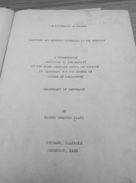
That’s quite the question to ask a recent graduate of an Interdisciplinary PhD program! Mine, completed in May 2017 at the Memorial University of Newfoundland, includes two faculties (Humanities & Social Sciences, and Education) and four subjects (Education, Gender Studies, History, and English Literature). However, the history of enslavement in the maritime Atlantic (The Middle Passage, colonial enslavement, slave rebellion, Abolition, and Emancipation) is a key specialization of mine.

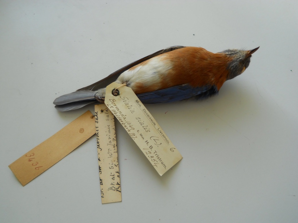
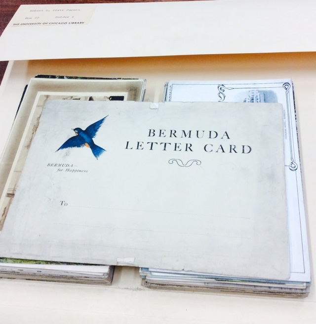
Mary Prince as an historical subject is a second specialization. Bermuda-born, Prince (1787/1788 – after 1833) is the first known black woman to have her story of enslavement and freedom written down and published. Her testimony, or slave narrative, The History of Mary Prince, A West Indian Slave, Related by Herself was first published in 1831. My work as a PhD student was partially to visit every territory in which Prince had lived (Bermuda, Grand Turk Island, Antigua, and London [UK]) and to confirm her testimony through primary sources and by visiting sites of enslavement associated with her and her parents. Mary Prince became a Bermudian National Hero in 2012. Please see my website maryprince.org where I have placed some of my findings, including historical photographs and images of documents gleaned from archives.

A third specialization is the Pedagogy of Remembrance. I have theorized an educational approach to open students’ critical historical consciousness in regard to histories of mass violence, such as The Holocaust, The Middle Passage, and the genocide of North American Indigenous Peoples. My approach, based on the work of others (see the bibliography following for titles authored or edited by Roger Simon, Peter Seixas, and Tom Morton), has five interrelated components and is keyed to autobiographical survivor accounts, such as slave narratives in the case of The Middle Passage and colonial enslavement.

Q: Why were you interested in the project?

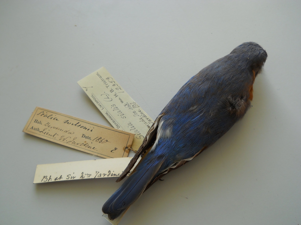
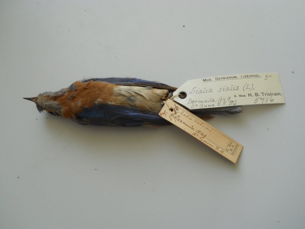
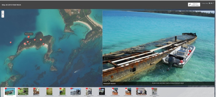
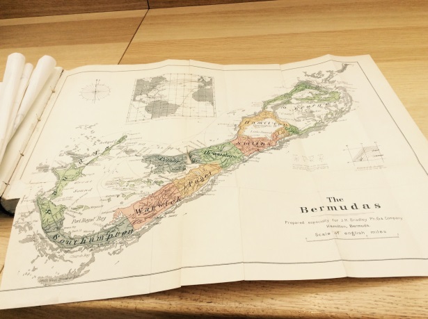
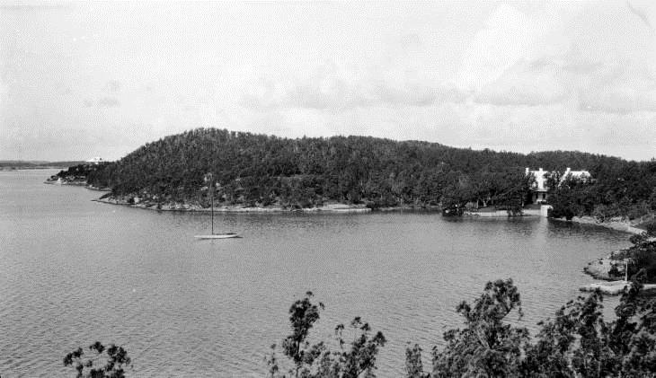
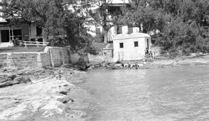
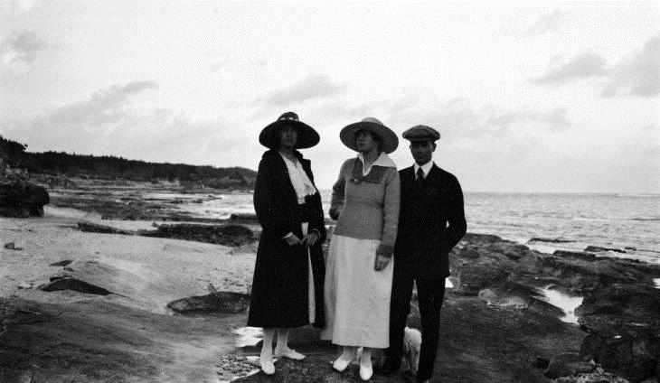
A focus of Empire, Trees, and Climate is Bermuda, the territory of Mary Prince’s birth, so, for me, any opportunity to visit Bermuda, the Bermuda Archives, and the National Museum of Bermuda was not to be missed.

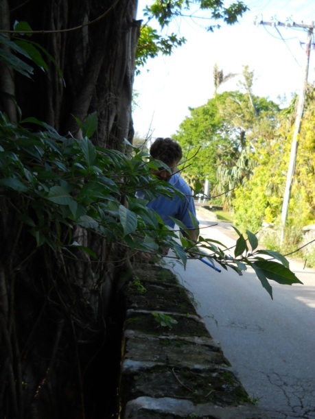
But there was also Cavendish Hall. One outcome of my PhD project was that I located two more structures associated with Prince in Bermuda, for a total now of five. One of the two structures I was able to locate, Devonshire Parish’s Cavendish Hall, was possibly built as early as the late 1600s. From its beginning, Cavendish was a home of the Darrell family. Although Cavendish was turned into condo units in 1969 and is almost unrecognizable from historical photographs, sections of the old building remain.

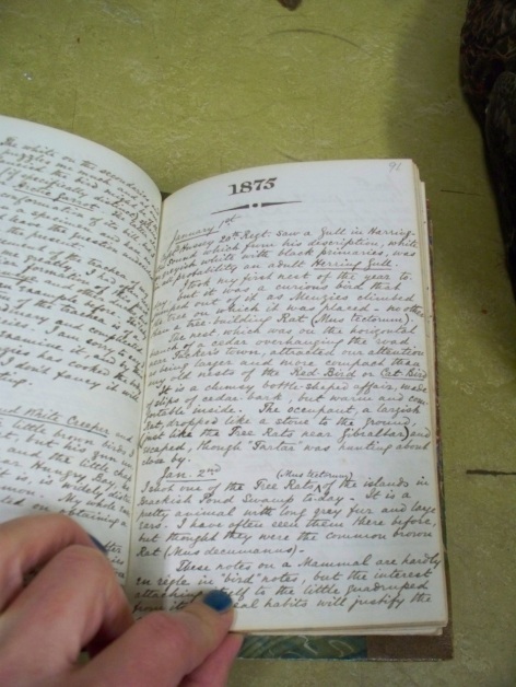
A primary source, “The Journal of John Harvey Darrell” compiled by his daughter Harriet Darrell long after his death, but written in the nineteenth century, informs readers that Cavendish was originally built entirely of Bermuda cedar. This means still-standing Bermuda cedar posts in the cellar may be well over 300 years old.

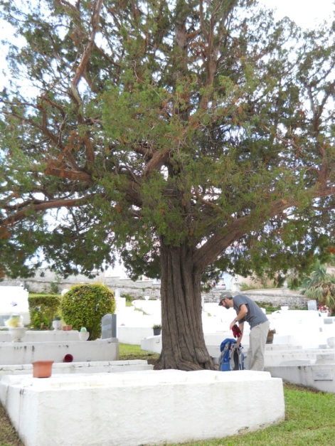
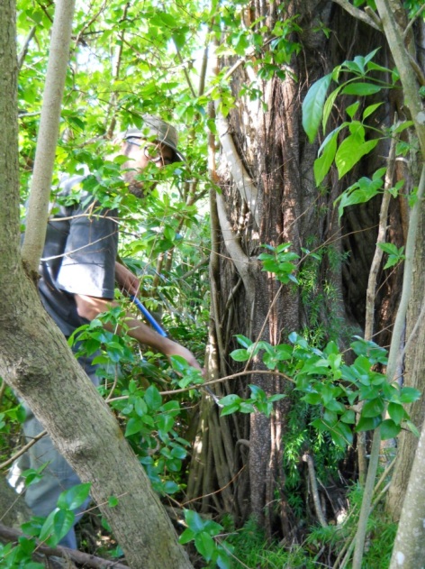
I was interested to find out more about the old home, and I did. Team member and dendrochronologist Adam Csank was able to visit Cavendish with me, and we gathered timber samples from Bermuda cedar posts in the cellar, as well as from a pine floor that is a later feature of the old home.

A short paper, “Bermuda’s Cavendish Hall, Enslavement, and Historic Timber,” that is based on my knowledge of Cavendish and also on Csank’s dendrochronological findings, was awarded second place in the 2017 Andrew Hill Clark Award for papers at the PhD–level. The Historical Geography Specialty Group of the American Association of Geographers gives the award annually. A finding of this research is that Emancipation (and, therefore, the cessation of unpaid labour) may have impacted timber flows of the maritime Atlantic as well as the designs house builders and shipbuilders used in their construction projects.

Recently, I have expanded this piece and Csank plans to add his voice. The result will be a co-authored paper, “Mary Prince, Enslavement, Cavendish Hall, and Historic Timber,” which we plan to publish in Historical Geography. I add here that when I joined the team in 2014, I never thought it would result in a co-authored paper with a dendrochronologist! This is an example of what interdisciplinary work can bring about.

Q: What did you contribute to the team?

My knowledge of colonial slavery as it existed in Bermuda assisted the team. For example, I helped to locate primary source evidence showing that enslaved persons were part of the labour force that built Bermuda’s Royal Naval Dockyard.

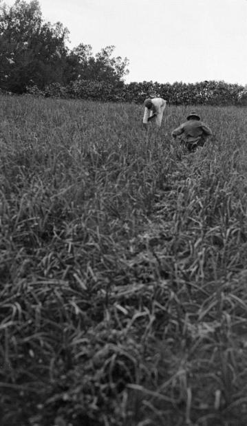
I also, however, have a literature background, and I believe that this, too, helped the team because it added to the team’s interdisciplinary nature. For example, my knowledge of Bermuda slave narratives augmented my thought about Bermuda’s agricultural past. An educated hunch put me on a jet bound for Bermuda last August (2017) where a visit to the Bermuda Archives to look at shipping manifests from the 1780s confirmed the existence of a large-scale pre-Emancipation onion plantation that has, until now, been overlooked. In 1781, for example, 658,500 pound of onions cleared Bermuda’s St. George’s and Hamilton ports combined. I’ve authored two short pieces about my preliminary findings regarding this onion plantation, one in Past Place (pages 9 & 10), and the other in MARITimes (see the bibliography following). This research keys to my postdoctoral work, which is focused on the Bermuda onion as a boundary object, but also looks at historic connections between Bermuda, the West Indies, and mainland American colonies.

Onion cultivation in Bermuda continued post-Emancipation right through to WWII when wartime interruptions, 1939-1945, followed by labour disputes with West Indian longshoremen in the early 1950s, brought an end to the trade. Texas-grown onions took over the market. No longer were Bermuda onions transported to West Indian or mainland markets. Even though Bermuda-grown onions were ready for market as a spring vegetable a few weeks earlier than Texas-grown onions, Bermudian onion growers were pushed out of the trade.

postcardbermudaonionfield1_0001.jpg

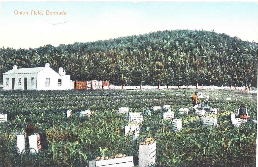
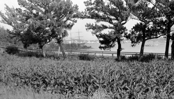
Figure 1: Onion Field, Bermuda (c. 1890), a postcard published by Wm. Weiss & Co.


postcardbermudaonioncultivators_0001.jpg

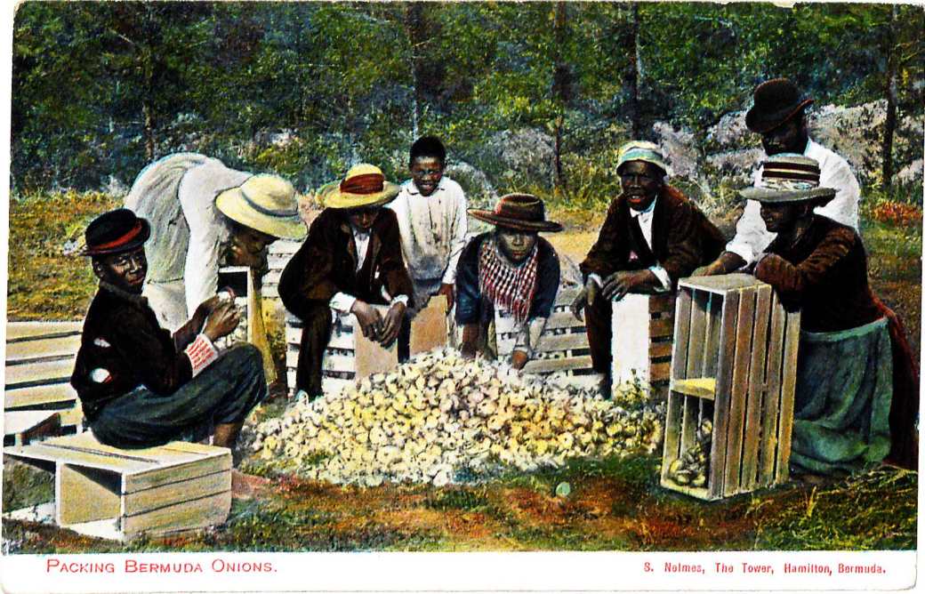
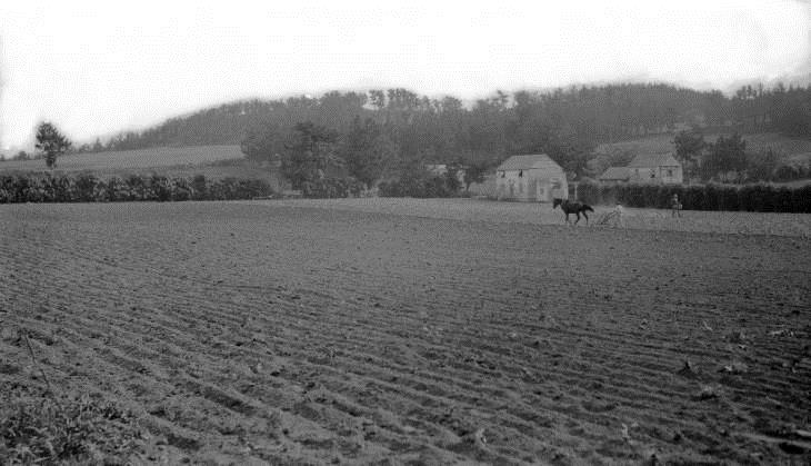
Figure 2: Packing Bermuda Onions (c. 1890), a postcard published by Samuel Nelmes.

One finding that keys to Empire, Trees, and Climate is that pre-Emancipation, the Bermuda planters found an expanding market in the West Indies for their onions, and as their exports grew through the decades leading to Emancipation, so did the sizes of their ships. Possibly, this speaks to an increase in the flow of mainland timber to Bermuda for the purpose of shipbuilding.

Q: What did you hope to find out?

My chief hope was/is to find more information about enslavement in Bermuda, the West Indies, and mainland colonies as it pertains to timber. Enslaved workers harvested timber and worked as sawyers, carpenters, and house and shipbuilders. They also built furniture.

Shipping records located at the Bermuda Archives indicate an increase in the transportation of timber clearing Halifax for Bermuda after construction of Bermuda’s Royal Naval Dockyard began in 1795. This timber may have been from either Nova Scotia or New Brunswick. Records located at Charlottetown, also indicate timber transports from Prince Edward Island to Bermuda in this period. Therefore, one finding about enslavement in Bermuda is that enslaved people working in various wood-based industries in the territory were possibly working with timber originating in Nova Scotia, New Brunswick, and Prince Edward Island.

One thing I’ve learned is that when a researcher sets out to undertake research on any given subject, she or he often finds compelling information about a related subject that was not originally sought. This is why reflection is such an important component of research. A researcher must sit with the data that has been collected, be it archival, archaeological, dendrochronological, or some other type, and reflect on what it means. How does it fit into, or how does it not fit into, an existing narrative?

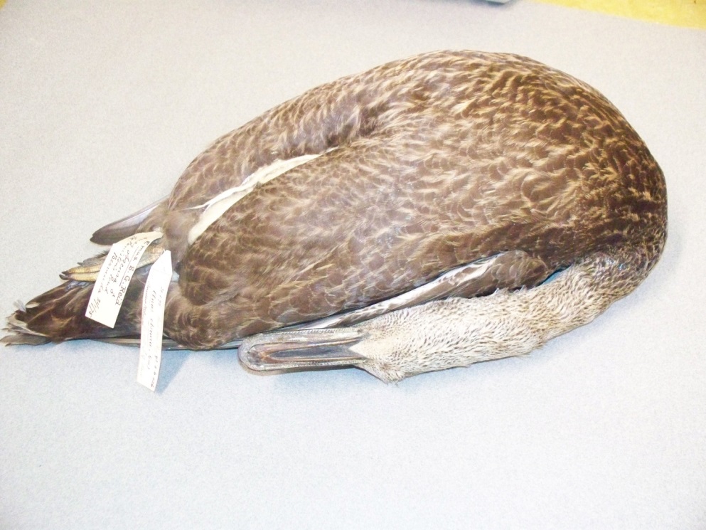
For example, Prince’s testimony, even as reduced as it was by the 1831 collaborative abolitionist storytelling, compiling, and editing team, spoke to me, albeit in a whisper, about the possibility of a Bermuda onion plantation. When I confirmed large-scale onion production by looking at shipping manifests located in the Bermuda Archives, I also learned that thousands of live ducks were shipped annually.

Yes, ducks! This finding has led to new research questions: What species of ducks were raised historically in Bermuda for shipping? Were the ducks raised solely for their flesh, or did they perform another function in Bermuda’s historical agricultural project? Where did the ducks originate? and How and when were the ducks transferred to Bermuda?

My hypothesis is that these were domesticated Muscovy ducks brought to Bermuda along with skilled enslaved Indigenous peoples from the Windward and Leeward Islands, and that the ducks were also used for pest control in the crops produced by enslaved labour. Additionally, duck dung may have helped to replenish soils exhausted from excessive nutrient uptake by exploitative agriculture, such as tobacco and sugar plantations. Both tobacco and sugar were tried as plantation crops in Bermuda soon after 1612 when settlement in Bermuda began.

Muscovy ducks Screen Shot 2017-12-10 at 9.15.19 AM.png

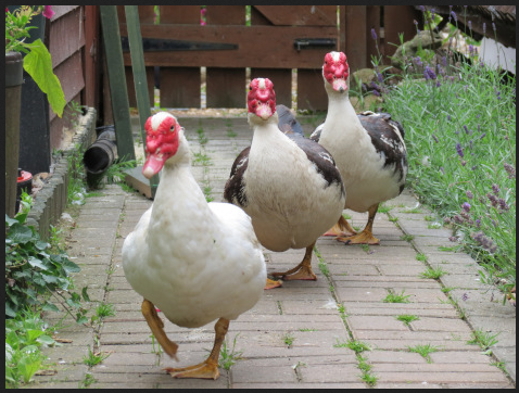
Figure 3: Muscovy ducks. Image from Wikimedia Commons.

Carl Sauer mentions briefly that the Muscovy duck was kept by island Carib people at the time of contact (The Early Spanish Main 59), and David Watts explains that prior to 1645 the Muscovy duck was incorporated into the mixed agricultural economy emerging in St. Kitts and Barbados (The West Indies 163). The English settled St. Kitts in 1623, and they settled Barbados four years later in 1627. Therefore, the time about which Watts writes is early days for both these two colonies. Watts adds that at this time, European settlers in St. Kitts and Barbados also made use of the Indigenous conuco method of agriculture common to both Carib and Arawak peoples, but whereas the Carib kept Muscovy ducks, the Arawak did not.

A conuco is a cultivation plot in which vegetable species that reproduce from cuttings are often planted in mounds. Starchy tubers such as sweet potatoes and manioc are the main components. Because these types of plants grow best in well-drained soil, the soil of a conuco was mounded when necessary. A conuco might be situated on any land suitable for growing, including sloped land, and between trees. Historically, when the soil of a conuco became depleted, it was left to rest for several years and another conuco was cultivated. Indigenous “kitchen” gardens as well as indigenous fruit trees augmented plant species grown in the conuco. My thought is that the Muscovy duck kept by the Carib people added to conuco and related Indigenous agriculture by way of pest control but also by duck dung, which helped to replenish the soil.

Bermuda was uninhabited by humans at the time the English settled the archipelago. Early settlers brought both black and Indigenous American people to the archipelago and enslaved them. Some of the enslaved Indigenous people brought to Bermuda may have come from English settlements such as St. Kitts and Barbados, or they may have been taken in raids on other islands. Some may have been Carib people who were familiar with the Muscovy duck. Food plants of Indigenous Americans were also imported. Sweet potato and arrowroot, both hailing from the Indigenous American food plant complex, were grown historically in Bermuda, for example. My thought is that the first generations of enslaved Indigenous cultivators in Bermuda may have practiced conuco agricultural methods, and kept kitchen gardens and indigenous fruit trees in Bermuda as they had on their home islands. They may also have kept Muscovy ducks.

It may also be that enslaved workers raised ducks, worked as “shepherds” to ducks, and also as caregivers to ducks aboard ships when the ducks were transported. They would have also constructed shipping crates for the live transport of the ducks. Because Bermudians had deforested their archipelago of Bermuda cedar for house building, shipbuilding, and for firewood by 1690, it may be that wood used to construct shipping crates in the 1700s was brought from mainland colonies. Once again, this keys to the flow of timber in the maritime Atlantic.

With the discovery of a pre-Emancipation onion plantation and the ducks, my hope to find out more about enslavement in Bermuda, the West Indies, and mainland colonies has taken the direction of a new and unforeseen historical story.

Q: What surprised you?

What can be more surprising than hundreds of thousands of pounds of onions being shipped annually from Bermuda, and thousands of ducks? Except that I haven’t been able to find a single mention of ducks in any secondary source about Bermuda.

In my mind, surprises are the best possible things that can happen when undertaking research. If you are able to receive surprises well, they may put your feet on a new path or enliven your thought process with a new idea.

Q: Why do you love your work?

What’s not to love about Bermuda? Especially when it’s January and you live in Canada?

I also love the interesting people I meet when I travel to do research. The Empire, Timber, Climate team members are terrific, but I also meet archivists, conservators, and other scholars, and they are great, too.

When I am in the field, reflecting on my findings, or maybe writing them up, time often slips by unnoticed. It’s peaceful, and I feel like I disappear into the historical story I am researching and telling. I love that feeling.

I also really love sharing my findings with interested others—by way of a history seminar, history class, public lecture, or a one-to-one discussion. My hope is to get my research out of the academy and shared with citizens young and old.

This brings my Research Profile to a close but also swings it back to my third specialization, the Pedagogy of Remembrance. By remembering and understanding The Middle Passage and colonial enslavement, people can better understand present social conditions—racism and its manifestations—that have arisen because of them.

The opening of historical consciousness means people may decide to work to repair existing relationships and to work for a more democratic future. This is what motivates me. I believe my research, and the sharing of my research, will help to make the world a better place.

I do this work for our children and grandchildren.

Bibliography

Darrell, Harriet, E. D., compiler. “Journal of John Harvey Darrell.” Bermuda Historical       Quarterly. July-September, 1945, pp. 129-143.

Maddison-MacFadyen, Margôt. “Bermuda Onions.” Past Place: A newsletter of the       Historical Geography Specialty Group of the American Association of Geographers. November 2017, pp. 9-10.

——. “Mary Prince and Bermuda Onions.” MARITimes, Vol. 30, No. 2, 2017, p. 23.

——. maryprince.org

——. “Reclaiming Histories of Enslavement in the Maritime Atlantic and a Curriculum: The History of Mary Prince” (Unpublished doctoral dissertation). Memorial University of Newfoundland, St. John’s, 2017.

Prince, Mary. The History of Mary Prince, A West Indian Slave, Related by Herself. 1831. Rev. ed. Moira Ferguson, editor. Ann Arbor: U Michigan P. 1997, pp. 57-94.

Sauer, Carl O. The Early Spanish Main. Berkeley: U of California P, 1969.

Seixas, Peter. “A Model of Historical Thinking.” Educational Philosophy and Theory, 2015. pp. 1-13.

Seixas, Peter and Morton, Tom. The Big Six Historical Thinking Concepts. Toronto: Nelson, 2013.

Simon, Roger I. A Pedagogy of Witnessing: Curatorial Practice and the Pursuit of Social Justice. New York: State U of New York, 2014.

Simon, Roger I., editor. The Touch of the Past: Remembrance, Learning, Ethics. New York: Palgrave MacMillan, 2005.

Watts, David. The West Indies: Patterns of Development, Culture and Environmental Change since 1492. New York: Cambridge U P, 1987.


BLOG #15: “Echoes of Bermuda”: Listening to past, present, and future soundscapes

By Katie Hemsworth

One of the main goals of Empire, Trees, and Climate (ETC) is to better understand past landscapes through an examination of climate, trees, and imperial trade. The term landscape has transformed over time to account for socio-cultural, historical, environmental, and political contexts (among others), yet it still seems to be rooted in visual interpretations and representations of the world. For instance, people often talk about “reading” or “gazing out at” the landscape – terms that are part of a broader set of visual ways of knowing that includes terms such as perspective, observation, charting, and imaging. Visual interpretations are indeed valuable (as we can see through Megan Prescott’s ETC work on visibility analysis as part of historical GIS and geotagging images, for example), but a more multi-sensory definition of landscape provides even more opportunities for understanding connections between the past, present, and future.

nonsuch csank and mark outerbridge

Figure 1: Dendrochronologist Adam Csank (right) and Mark Outerbridge (left, Conservation Services) photographing and “gazing out” at the landscape from Nonsuch Island in May 2015 (Photograph credit: Kirsten Greer). We can also ask: what might they have heard?

In this blog post, I want to address the role of sound, listening, and sonification in helping to expand the trajectories of the Empire, Trees, and Climate project. As mentioned in a previous post, I’m a cultural geographer whose work focuses on sonic ways of knowing and being in the world. For this project, I’m particularly interested in thinking about what might be learned about place, climate change and energy transitions by listening to and making sound. This involves listening to the present and the past (the latter being a trickier task, but not impossible!) in order to shape future practice. In the latter half of the post, I’ll introduce a new and exciting sound archive layer for our GIS-based storymap (coming Jan. 2018), designed by Megan Prescott and Kirsten Greer. The sound layer currently uses audio files from the Macaulay Library at the Cornell University Lab of Ornithology.

*A note about the title: “Echoes of Bermuda” is the name of a music album that co-researcher Margot Maddison-MacFadyen found in a cardboard box in Hunter River, PEI, of all places! The title works well for our purposes of listening to the past. I’m still trying to learn more about the band (there seems to have been an Esso Steel Band of Bermuda and an Esso Steel Band of Trinidad – perhaps there are others?). For now, their name points to the relationship between sound, culture, and imperial histories; steel drums were made from oil barrels left on the islands primarily by the British Navy, and I’m learning that Esso sponsored several bands like this one. The album’s music serves as an echo chamber of a place with many histories, and its material (sonic, visual, and tactile) existence ensures it also remains rooted in the present.

EchoesofBermuda

Figure 2: Echoes of Bermuda by Esso Steel Band. (Year unknown)

Sound and interdisciplinary research

How can a sonic sensibility help tell the stories of past places?

To start, a key question to consider in any sound-based inquiry is: how do we listen? It seems like a simple question with a simple answer: with our ears. This is certainly true, but if sound waves are actually vibrational, then it’s more than just our ears. We can feel vibrations throughout our entire bodies – soundwaves interact with skin, bones, central nervous system, and limbs. The reason I highlight this vibrational quality is because it opens up even more possibilities for interdisciplinary research than only focusing on what our ears can detect. Vibrational listening can tell us much about a place like Bermuda, from cicadas to cahows to water to tree rings to oil drum music (and much more – we’ll be addressing these “soundprints” in a future publication). What I appreciate about a sonic approach is that it is useful across the social sciences, humanities, and sciences, and that it draws on more-than-human tools and ways of knowing. Think, for instance, about the ways in which microphones, speakers, and cables extend our bodies’ abilities to make and perceive sound. A sonic sensibility is necessitates critical engagement questions about space and time.

Key questions that we’re currently asking, and which can be taken up in all kinds of interdisciplinary inquiries, include:

  • What did places sound like in the past? How did imperial trade affect these soundscapes?
  • What can a greater attentiveness to soundscape tell us about environmental and cultural change?
  • How might sonic methods be used in historical inquiry? At what stage are they most useful?
  • What is the utility of audio recordings and sound archives in geographical, environmental, and historical research?

Incorporating sonic methods

Sonic methods involve a wide range of auditory knowledges, techniques, and instruments to approach a problem or phenomenon. For example, “deep” listening and soundwalking require little more than a moving body, while (digital) audio storytelling often involves a much more complex network of people, technologies, power sources, recording and processing equipment, ICTs, and so on. One method is not necessarily “easier” than another; even those that use minimal equipment must ask critical questions about sound and its perception or mobilization.

In some research, sound is incorporated into the project from the outset, with questions being designed around sonic ways of knowing or addressing a sound-based issue, such as noise pollution. Others might embrace sound later on, in the representation or dissemination of data, for instance. An excellent example of this is a project led by Dr. Scott St. George and Daniel Crawford at University of Minnesota, featuring musical interpretations of climate data (my sense is that the climate data came first, and then the music was used to communicate it in an artistic way; see also St. George et al., 2017).

For Empire, Trees, and Climate, we’ve introduced a sonic sensibility somewhere in the middle. Sound was not necessarily a primary tool or subject of investigation in the beginning, although I should note that part of this project intersects with knowledges gathered by  project leader Dr. Kirsten Greer in her doctoral research on historical geographies of ornithology (a decidedly sonic field of study!) and her postdoctoral research on marine zoogeographies). However, for Empire, Trees, and Climate, sound has come to play a role in a) thinking of alternative ways to track biodiversity change and energy transitions, and b) communicating findings around climate change and imperial histories of place. For the rest of this piece, I want to share how we’re using sound-based data and sonic methods to enhance our (forthcoming) storymap.

Mapping soundscape: Adding a sound layer to the ETC storymap

In a piece for The New York Times, Bernie Krause wrote that biodiversity change is often heard before it is seen (see also Anja Kanngieser, 2015, for an excellent piece in GeoHumanities on the relationship between sound, geopolitics and the Anthropocene).

Building on this point, we have begun to collect existing audio recordings of birds, insects, and other sonic beings from Bermuda to establish a sound archive as the first stage of a sound layer for our ESRI storymap (which is coming to a computer near you in January 2018 – keep watching this website for updates!). Once it’s live, you can visit the sound layer under “Proxies of Climate” in the storymap to listen to some of the archived sounds and read through their accompanying attribute tables. We’re still in the initial stages of “sonifying,” so I’ll update as we progress. For now, here are some screenshots:

Screenshot-2017-12-8 Story Map Series

Figure 3: Screenshot of the sound layer under “Proxies of Climate.” Individual icons pinpoint the locations of each sound recording, most of which feature the sounds of the Bermuda petrel (“cahow”), and some include introductions by their recordists.

Screenshot-2017-12-8 bird calls

Figure 4: Examples of audio clips that accompany pinpoint data in the sound layer (audio credit: Macaulay Library at the Cornell University Lab of Ornithology). This particular set of recordings were conducted by Mark Reaves, a Cornell-based sound technician who was brought to the island in 2003 to help record the Bermuda petrel (“cahow”) as part of conservation strategies.

In establishing a sound archive and sound layer as part of the broader ETC project, we hope to address at least five major aims:

1. Preservation of sounds and sound-makers

A key purpose of the sound layer for the storymap is to establish an audio record of the kinds of species that have been part of Bermuda’s landscape for decades, some of which are endangered. In doing so, we are drawing on the utility of field recording for preserving sounds and the beings that make them. Of course, recordings are always to some extent a representation of something on a certain day, at a certain time, and shaped by the equipment, techniques, and recording cultures. Nonetheless, it serves as a record of life and place at a given moment in time, a particularly important practice in environments that have undergone rapid change (often against the will of local populations) and biodiversity loss. Importantly, as sonic geographer Michael Gallagher (2015) writes, field recordings are not only representational, nor should they only be conceived as clips of something “captured” in the past. Instead, recordings are dynamic, performative, and affective, unfolding in the present and changing with each playback.

2. Mapping biodiversity and conserving endangered or at-risk species

As it develops, we hope that the storymap can be used as a resource for tracking changes in biodiversity and asking critical questions about those shifts. For example, what species were heard in the 20th century that might not be heard now, and what caused their silence or disappearance? Conversely, what species are heard now that were not before, and why?

And how might sonic methods help in conservation efforts?

One of Bermuda’s most famous birds, the petrel (also known locally as the “cahow”), was thought for centuries to be extinct, having experienced near-immediate decline during the island’s colonization in the early 1600s. Yet in the early 1950s, a team that included Robert Cushman Murphy, Louis S. Mowbray, and David Wingate (a teenager at the time), discovered eight nesting pairs on the island. Wingate – a naturalist, conservationist, and ornithologist – has dedicated much of his life to conserving the cahow population. Given that the bird was known for its haunting, moan-like call (leading some sailors to nickname Bermuda the “isles of devils”) the cahow’s shifting presence and absence has surely shaped the soundscapes of different parts of the island.

In addition to David Wingate’s integral contributions during his time as Government Conservation Officer (1966-2000), audio recordings have been central to more recent conservation efforts. In 2003, Terrestrial Conservation Officer Jeremy Madeiros and sound technician Mark Reaves (Cornell University) recorded cahow populations and later used playback of these calls to attract the birds to parts of the island that would be safer for nesting (see photos below of Nonsuch Nature Island Reserve nests). We hope  researchers and conservationists might find our sound archive a useful resource for similar pursuits in the future, but we also recognize the need for future research on the ethics of using existing recordings for such purposes.


3. Archiving the life geographies of early (and contemporary) recordists

The sound archive can also be used by people whose research is not necessarily focused on Bermuda (or even the species presented in the clips), but who instead have an interest in histories of audio recording techniques, equipment, and objects of study (what was worth recording?). In several audio clips, listeners can hear the recordist introduce their recording, thus preserving their own voice and some form of their subjectivity in addition to the sonic environment they intended to represent. This sound archive, therefore, helps document the histories of individuals who have visited or lived on the island, and who decided specific species were important to record, thus shaping cultures and histories of phonography.

In one case, our collection of Bermuda-based recordings has strengthened an existing research link with a project at Queen’s University led by Drs. Laura Cameron and Matt Rogalsky. Their SSHRC-funded project,  “Recording Nature: The Life Geography of William W. H. Gunn,” traces the life geographies and contributions of this famous Canadian sound recordist. Our storymap includes recordings made by “Bill” Gunn in Bermuda, as well as other audio clips from his personal library – a unique connection with the Queen’s scholars who were not previously aware of Gunn’s presence in Bermuda. I had the pleasure of presenting in the same session as the research duo at Challenging Canada 150: Settler Colonialism and Critical Environmental Sciences (a symposium hosted by Dr. Kirsten Greer and Dr. April James at Nipissing University). Here they are below presenting on Bill Gunn’s recording practices, which included the parabola device pictured on their presentation screen.

IMG_4433

Figure 8: Dr. Laura Cameron (Geography & Planning, Queen’s University) and Dr. Matt Rogalsky (Dan School of Drama and Music, Queen’s University) presenting “Gunn’s ‘A Day in Algonquin Park’: settler colonial listening and erasure.” Their subject, William W.H. Gunn, recorded the petrel (“cahow”) bird in Bermuda. His recordings are included in the sound layer of our storymap.

4. Acknowledging the historical role of sound in scientific study

The Empire, Trees, and Climate project draws partly on scientific tools and techniques to understand and tell histories of climate. Thinking about this broader project’s focus on dendro-provenancing to help locate the origins and livelihood of trees (see blog posts by Laurel Ann Muldoon and Dr. Adam Csank), I wonder what kind of role of sound has in the production of tree rings, or how we might use sonic methods as part of this dendro-provenancing project. If anything, the fact that sound is vibrational might mean that we can think about the vibrational stories of trees; indeed, artists have experimented with slices of tree rings to turn ring data into piano music played on vinyl records.  My own investigation of the ties between tree ring data and sound is best left for the future, but I mention it to acknowledge that sound is often left out of the histories of quantitative and qualitative methods, even though many of the instruments and techniques used in scientific research have their roots in sound. Seismology, ultrasound, stethoscopes, impulse responses, and hydrophones all draw on some kind of vibrational, rhythmic, and/or auditory indicator. How can listening to water flows through trees – for example, using ultrasound to hear the breaking of water columns in trunks and branches (Haskell, 2017) – tell us something more about the geographies of trees or conditions of climate?

5. Building sonic imaginations of the past (and future)

As Kristy E. Primeau and David E. Witt (2017) noted in an online piece about “archaeoacoustics” for The Conversation, “[w]hen thinking about archaeological sites, we tend to conceive of them as dead silent – empty ruins left by past cultures. But this isn’t how the people who lived in and used these sites would have experienced them.” Likewise, I mentioned at the start of this post, until very recently, geographies of landscape tended to privilege visual ways of knowing land. Part of my role in this project is to research and communicate the role of sound in understanding histories of imperial trade, colonization, and environmental change. As I have mentioned, this has involved the creation of a sound archive and sound layer for the ESRI storymap, with particular attention to Bermuda, but this is only the beginning.

Eventually, we may be able to use the existing data collected in combination with the Soundshed Analysis Tool in ArcGIS to try to understand what the island would have sounded like in different time periods – similar to what our trusty GIS technician, Megan Prescott, has already done with visibility (or line-of-sight) analyses. Drawing on location and elevation data, as well as input variables such as frequency, sound source height, and air temperature, the Soundshed Analysis Tool (or something akin to it) might be used to establish what certain areas of Bermuda might have sounded like decades or even centuries ago. Soundshed analysis could help establish a sense of what Bermudian landscapes sounded like when, for example, the Bermuda cedars and cahow populations were abundant (recognizing that they simultaneously made their own soundwaves while also shaping the paths and qualities of others). Just as importantly, it may be used as a model to project what the islands’ changing soundscapes can tell us about the future.

Thanks for reading this update. Stay tuned for future sound-related posts and trajectories!

References

Gallagher, M. (2015). Field recording and the sounding of spaces. Environment and Planning D: Society and Space, 33(1): 560-576.

Haskell, D.G. (2017). The Songs of Trees: Stories from Nature’s Great Connectors. New York: Viking.

Kanngieser, A. (2015). Geopolitics and the Anthropocene: Five propositions for sound. GeoHumanities 1(1): 80-85.

Primeau, K. and D.E. Witt. (2017). Soundscapes in the past: Investigating sound at the landscape level. Journal of Archaeolological Science: Reports, https://doi.org/10.1016/j.jasrep.2017.05.044

St. George, S., D. Crawford, T. Reubold, and E. Giorgi. (2017) Making climate data sing: Using music-like sonifications to convey a key climate record. Bull. Amer. Meteor. Soc., 98: 23–27, https://doi.org/10.1175/BAMS-D-15-00223.1

BLOG #14: Empire Trees and Climate in Chicago – Part 1 of 3

Kirsten Greer

Adam Csank and I travelled to Chicago March 29th to April 2nd, 2017, to present preliminary results of our project at the American Society of Environmental Historians conference.  While in Chicago, we engaged in research related to our project such as a visit to the University of Chicago Archives to examine the fonds of the geographer Robert S. Platt.  Platt, as a PhD student, travelled to Bermuda in the spring and fall of 1919 to undertake research for his dissertation Resources and Economic Interests of the Bermudas (1920).

We are currently working on a “Platt Bermuda PhD layer” for a tour map in our HGIS prototype using ESRI Story Maps.  Platt’s extensive photographic collection is housed at the American Geographical Society Library at the University of Wisconsin-Milwaukee. The collection provides a valuable resource to analyze landscape change over time in places such as Bermuda.

1

Figure 1: Our time series model for a “Platt Bermuda PhD layer” using ESRI Story Maps.

The visit to the “Windy City” of Chicago also allowed us to explore some new research trajectories emerging from the project, including the examination of Platt’s field approach to regions in northern Ontario, tracing the possible movement of timbers from northern Ontario to Chicago after the Great Fire of 1871, and uncovering Anishinaabe links to the Columbian World Exhibition in 1893.

2

Figure 2: Platt used northern Ontario as a case study to his “Field approach to regions” in 1934, which he published in the Annals of the Association of American Geographers in 1935.

3

Figure 3: A diorama of the “Great Fire” of Chicago in 1871 on display at the Chicago History Museum.

4

Figure 4: “A Map of Chicago Showing the Burnt District” (1871) on display at the Chicago History Museum.

5

Figure 5: We visited Stockyards Brick to take some timber samples from St James Catholic Church built 4 years after the “Great Fire”.  Stockyards Brick reclaims vintage brick and other materials from structures scheduled for demolition throughout the Midwest, including in Chicago.

6

Figure 6: A diorama of the World Columbian Exhibition in Chicago in 1893 on display at the Chicago History Museum.

7.jpg

Figure 7: Nipissing University and the Dokis First Nation are working closely with the Chicago Field Museum to repatriate some of the remains of Anishinaabe ancestors that were put on display at the 1893 World Columbian Exhibition.

The following section of this blog post is Part 1 of 3 on the research activities in Chicago this past year, which focuses directly on Bermuda.  Part 2 and Part 3, which will follow in the weeks to come, will highlight some of the research connections evolving from Empire, Trees, and Climate, Chicago, and northern Ontario.


Platt at the University of Chicago Archives

Visiting the University of Chicago was a highlight of the trip.  The University of Chicago looms large in the history of geography.  Its Department of Geography was the first to be established at an American university (1902-1903).  Geologist Rollin D. Salisbury and geographer/cartographer John Paul Goode were key figures in the founding of the department, which expanded throughout the early twentieth century. Many geographers played a major role in defining the discipline, including Salisbury, Goode, Harlan Barrows, Derwent S. Whittlesey, and, the subject of our interest, Robert S. Platt (1891-1964).

8

Figure 8: Requesting the Platt and Barrows fonds at the University of Chicago Archives.

Robert Swanton Platt was born in Columbus, Ohio, and graduated in Philosophy from Yale in 1914.  After a year of teaching in China with Yale, he entered the Department of Geography at the University of Chicago in 1915, completing his Ph.D. in 1920.  Platt spent his career in the Department of Geography at the University of Chicago, first as an instructor (1920), then as an Assistant Professor (1921-1927), Associate Professor (1927-1939), and Professor (1939-1957), and finally as Chairman (1949-1957).  Richard Hartshorne (1964, p.630) described Platt as “a scholar adventurer of a salty philosophical turn of mind, a student ever open to the adventure of ideas, to the adventure of seeing far and different quarters of the world, and to the adventure of getting to know people of all parts of the world.”

Platt pursued his doctoral fieldwork in Bermuda in 1919.  As a PhD student, Platt was influenced by his mentor Harlan H. Barrows (1877-1960).  Barrows came to the University of Chicago in the early years of the new Department of Geography, and was appointed full professor in 1914, and then chair of the department during the year that Platt conducted his fieldwork in Bermuda in 1919.  Barrows played a significant role in the developing fields of historical geography and the conservation of the environment and natural resources during his time at the University of Chicago.

Platt examined the “micro-geographies” of regions, especially in places in the Caribbean, Latin America, and the Great Lakes border regions.  He once stated, “In comparison with my history minor [at Yale], geography had the advantage of going more to the field for direct observation instead of going to the library to read about things that are no longer visible” (Hartshorne 1964, p.631).  Platt chose to focus on Bermuda for his PhD, and travelled there in the spring and fall of 1919.  He completed his doctorate in 1920.

9

Figure 9: Platt’s PhD dissertation at the University of Chicago library.

10

Figure 10: The map of Bermuda in Platt’s PhD dissertation at the University of Chicago library.

Platt based his research on fieldwork and photos of Bermudian landscapes, ranging from agricultural lands, animals, quarrying, and historical buildings, to Bermuda’s social life.  My main objective of the visit to the University of Chicago Archives was to examine his fieldnotes, and to link them to his historical photographs.  Platt’s photographs are now housed at the American Geographical Society’s collection at the University of Madison-Milwaukee, and serve as a valuable tool in retracing historical landscapes and geographical fieldwork in the past.

11

Figure 11: A collection of Bermuda postcards that are some of the materials in the Platt fonds at the University of Chicago Archives.


Platt’s Fieldnotes and Photographs

Robert S. Platt first arrived in Bermuda on March 4, 1919.  He described entering the Hamilton Harbour and how the landscape appeared “like high sand dune topog[raphy].”  He observed the “dark patches” of Bermuda Cedar and the grass covered slopes.  He also noticed “floating sea weed like that seen in the Gulf Stream.”  Before embarking, Platt and his group were visited by the Health Officer on an eight-oared long boat, all rowed by “colored rowers.”  There also was a military officer on board at dock to give them permit to land (March 4, 1919; Robert S. Platt Papers, Box 13 Folder 1).

12.png

Figure 12: The weather data of Bermuda for Platt’s spring research in Bermuda in 1919.  This is an example of how we are integrating historic weather data into our research and prototype.

Platt set-up his field research base in Bermuda at the Soncy Estate in Pembroke Parish.  While there are no notes on his connection to the estate, we can garner some clues from Platt’s photographs of the estate.  For example, Frances Horsfall is shown in a few photographs of Soncy Estate.  Frances Horsfall is possibly related to Lucy Frances Horsfall (Horsfall 1983), whose mother was a niece of the U.S. President, Rutherford Hayes.  Lucy’s mother, who was from Columbus, Ohio, lived with Rutherford Hayes and his wife in the White House, where she met Lucy’s father.  Her parents were married in the East room, in 1878.

13.png

Figure 13: Frances Horsfall in front of the Soncy Cottage where Platt lived during his time in Bermuda.

14.jpg

Figure 14: Bermuda, Soncy estate in Pembroke Parish from across Soncy Bay at Norwood estate.  Bermuda. September, October 1919. Photo 2. 9/24. Soncy from Norwood Hill. 9 a.m. B. 16 1/25. West.  Note the dense coverage of Bermuda Cedar on the property.

According to Lucy, the “house was on the harbour and the sheltered cove was ideal with its clear water and sandy bottom.”  It was built by her father in 1883, “on a point of land stretching into the harbour. It was of white stone, with a white stone roof, green shutters and a wide stone verandah, a lawn shaded by cedar trees ran down to the water” (Horsfall 1983).

15

Figure 15: Bermuda, entrance road to Soncy estate at Soncy estate in Pembroke Parish.  Bermuda. September, October 1919. 9/14. Soncy entrance. 2:40 p.m. 32 1/5. B. Northeast.

Lucy remembered fondly: “The entrance drive was beautiful. First a straight level road between tall hedges – on one side hibiscus, gay with red flowers, and on the other side, acalifa with its rich varied foliage – and a few cocoanut palms. The road then wound past a lagoon, edged by mangrove, and finally arrived at the front steps. It then continued around the “Circle”, a half acre of lawn, planted with royal palms, pandanus, tall candelabra cactus, and a flame tree” (Horsfall 1983).

Platt’s fieldnotes reflect a network of local informants who provided information and details on various geographic topics.  Some of the names on the top of his pages include Mr. Darrell, Mr. Spurling, Mr. C, Mr Hayward, Mr. H. Butterfield, Mr. Gosling and Miss Heyl.  The photographs highlight other people such as the Applebys and Pearman.

16.jpg

Figure 16: Bermuda, Bowman, Applebys, Pearman & Gosling at Soncy Cove.  Bermuda. September, October 1919. Photo 12. 9/20. Soncy Cove – . 11:45 a.m. B. 11 1/25. Northwest.

17.jpg

Figure 17: Bermuda, Elise Gosling, Maisel Appleby and Robert S. Platt on shore of Crow Lane Bay in Paget Parish.                  Bermuda. March 19, 1919. Photo 95. 3/22. Crow Lane Bay – E.G., M.A., R.S.P. [Elise Gosling, Maisel Appleby, Robert S. Platt]5:30 p.m. 8 1/50. East. B -.

18

Figure 18: Bermuda, Mr. Bowman with binoculars at wall on Town Hill; Bermuda. September, October 1919. Photo 1. 9/16. Mr. Bowman. The peak. 4 p.m. B. Northeast.

19.jpg

Figure 19: Bermuda, Tucker H. and Lewis Hayward outside dwelling; Bermuda. October 1919. Tucker H. & Lewis Hayward. 9:15 a.m. B. 8 1/25. Northeast.

Platt was especially interested in economic and environmental activities across the archipelago.  He made numerous notes on landscapes, animals, vegetation, climate, energy use, and trade, which provide the primary source material for his 1920 dissertation.  He documented how Bermudians grew all sorts of vegetable crops such as onions, arrowroot, potatoes, celery, and parsley.  According to Platt, onions could grow in no soil, which made it a “‘poor man’s crop’” (September 30, 1919, Robert S. Platt Papers Box 13, folder 4).

20

Figure 20: Bermuda, two men weeding an onion field in Smith’s Parish; Bermuda. March 19, 1919. Photo 82. 3/19. Weeding onion field, Smith’s – negro and white, 4:30 p.m. 8 1/25. North. C.

21.jpg

Figure 21: Bermuda, arrowroot field on Saint Davids Island; Bermuda. October 1919. Arrowroot, St. D. [St. David’s] 8:30 a.m. B. 11 1/25. North.

22

Figure 22: Bermuda, crops on reclaimed marshland at Devonshire Marsh.  Bermuda. March 19, 1919. Photo 54. 3/15. Parsley and celery,  Devonshire Marsh. 3 p.m. 11 1/50. Northwest. C.B.

Animals also featured in Platt’s fieldnotes and photographs, including the role of horses in transportation and agriculture.  According to a Mr. King, the “best horses come from Canada” despite attempts to bring horses from Jamaica and South America.  He mentioned there were not as many in Bermuda, and that there were 400 live horses in Bermuda in 1919 (October 13, 1919; Robert S. Platt Papers Box 13 Folder 1).


23.jpg

Figure 23: Bermuda, potato field in Southampton Parish being tilled by a horse-drawn plow, Bermuda. October 1919. Potato field, W. Southampton. 2:45 p.m. B. 8 1/50. Southeast.

Research into Platt’s doctoral fieldnotes prompted me to reflect on our own fieldwork photographs, especially after uncovering his notes about measuring the circumference of a Bermuda Cedar (15 inches) in the Devonshire Church cemetery.  For example, Adam and I visited the Devonshire Church on our preliminary research trip to Bermuda in December 2014.  Our December 2014 visit involved dendroprovenancing and archival fieldwork in order to plan our May 2015 research trip with team members Kimberly Monk, Kirby Calvert, and Margôt Maddison-MacFadyen.

24.png

Figure 24: A data layer for Bermuda Cedar tree core sampling across the island, including trees in the Devonshire Churchyard.

25.png

Figure 25: The location of the Bermuda cedars we sampled in the Devonshire Churchyard, December 2014.

26.jpg

Figure 26: We cored several Bermuda cedars at the Devonshire Parish church cemetery in December 2014, the same site where Platt described a large Bermuda cedar.

27

Figure 27: Adam Csank coring a Bermuda cedar at the back of the Devonshire Church cemetery.

28.jpg

Figure 28: Mark Outerbridge, Conservation Services, coring a Bermuda cedar from a Bermuda cut stone wall at the back of the Devonshire Church cemetery.

One important find in Platt’s fieldnotes were his entries on the role of the Canadian Weather Bureau in sending instruments and instructions to Bermuda to record weather data. We highlighted this in a previous blog.  According to Platt, Sergeant Wilkes was the observer, and the equipment included a wind vane, cup anemometer, a mercury barometer (in the building); a wet and dry bulb, max of min thermometer (in the kiosk); and an outdoor black bulb thermometer and a thermometer lying on the grass (October 10, 1919; Robert S. Platt papers, Box 13, Folder 1).

29

Figure 29: Platt’s notes on the climate of Bermuda included details on the role of the Canadian Weather Bureau in sending instruments and instructions to Bermuda to record the weather.

Over the next few months, we will integrate several Platt materials into our HGIS prototype. We also plan to write and publish a journal article on Robert S. Platt’s geographical fieldwork and photographs to examine landscape change over time in Bermuda.  Stay tuned for Part 2 and Part 3 of Adam Csank’s and my 2017 research trip to Chicago.


Overview #1: Our Blog Contributions to Date

OVERVIEW #1: AN OVERVIEW OF OUR ACTIVITIES

Over the next several months, we will be wrapping up our Empire Trees and Climate project with a few more blog posts on research activities, publications, team member profiles, and research trajectories, as well as an interactive HGIS prototype using ESRI’s Story Maps.

What follows is an overview of what we have accomplished to date.

real-world-geography

RESEARCH BLOGS

BLOG #13: A New Project Partner and The History of Bermuda’s Climate Records

Kirsten Greer & Laurel Muldoon

A major output of our SSHRC Insight Development project is to reconstruct Bermuda’s climate using historical meteorological records from the 1840s to the present.  We are currently contextualizing the production of Bermuda’s historical climate data to create a better understanding of cultures and climates past and present.  Bermuda’s climate records reflect the different colonial projects that shaped the islands, which involved the British military and navy, trans-Atlantic trade, the US army and navy, and the tourism industry.  This past year, we visited the Canada Science and Technology Museum in Ottawa to establish a new partnership, and to do conduct research on some of the individuals and instruments involved in Bermuda’s climate records.

BLOG #12: Empowering HGIS Research at ESRI Canada User Conference October 2016

Megan Prescott

An overview of the 2016 ESRI Canada User Conference in Toronto October 5th, 2016, with the prospect of absorbing information that would lend itself to our online mapping application and other HGIS projects.


BLOG #11: Empire, Trees and Climate at the CAG in Halifax May/June 2016

Kirsten Greer

Team members from Empire Trees Climate attended the Canadian Association of Geographers Meeting in Halifax this past June (May 30th to June 4th, 2016).  The team presented a number of research papers in a special session devoted to interdisciplinary work in geography: “What Does it Mean to do Interdisciplinary Research?  Exploring Mixed Methods in Geography through the Lens of Critical Physical Geography.”  The annual conference was hosted by Dalhousie University and Saint Mary’s University, and provided an ideal venue to share project findings and to highlight the historical connections between Halifax, Britain, Bermuda, and the West Indies.  The following photo essay is based on our CAG session and the fieldtrip we organized for the conference.


BLOG #10: Dendrochronology and Stable Isotope Research at Nipissing University

Laurel Muldoon

Tree rings are a bio indicator of their surrounding environment and assist in climate reconstructions.  They can provide an insight into seasonality, ecosystems and hydrological cycle functions in periods of climate change.  We call the science of studying tree rings, dendrochronology. Although we can gain a ton of information from ring width variability alone, for example dry summers can lead to narrow ring widths and we summers to wide rings, we can also use stable isotopes of carbon δ 13C  and oxygen δ 18O  to investigate past precipitation and temperature regimes.

The isotopic lab at Nipissing University is equipped with an Elementar vario Pyro cube coupled to an Isoprime VisION Mass Spectrometer, which has the ability to analyze stable isotopes of carbon, oxygen, hydrogen, nitrogen and sulphur. The lab is used for stable isotope dendrochronology, which pertains to understanding past and present climate conditions to further enhance climate proxy record chronologies.


BLOG #9: Science and Art of HGIS

Megan Prescott

This entry describes an integration of quantitative and interpretive techniques for identifying vantage points for landscape artists using visibility analysis. Building on my previous blog, georeferenced resources are used to generate coordinates for visibility tools and aid in line-of-sight interpretations. The goal of this entry is to review and apply two visibility tools within ArcGIS which allow us to estimate the vantage points of a past observer, painter Johnson Savage. This will build toward a future post by Kirsten Greer which will provide an overview of the role of 19th-century British military and navy officials in producing geographical knowledge of colonial landscapes through map-making, surveying, watercolour sketches, photography, natural history specimens, and meteorological recordings.


BLOG #8: Geotagging Images Then and Now

Megan Prescott, Kirsten Greer, Kirby Calvert

An overview on how to digitally prepare a few maps of Bermuda so that they could be compared in layers using GIS. These layers can then be used to determine the coordinates where these watercolours and photographs were taken by providing the location of objects in the landscape at the time as reference, making them a valuable step before geotagging (assigning coordinates to an image).


BLOG #7: Maddison-MacFadyen on Historical Timber Ponds in the North Atlantic

Margot Maddison-MacFadyen headed to New Brunswick on a preliminary research trip to find the locations of Royal Navy mast ponds on the St. John and St. Croix rivers. She visited the New Brunswick Museum in St. John, the Charlotte County Archives in St. Andrews, and the Provincial Archives of New Brunswick in Fredericton. At each location, she made significant finds and met fabulous archivists and history enthusiasts. She is looking for mast ponds because sunken masts may still be found at these sites. If sunken masts are found, then timber fragments may be procured from them that will then be analyzed and dated. In some cases, these submerged masts might be the only existing remnants of old growth Eastern White Pine forests of New Brunswick, Nova Scotia, Maine, and New Hampshire.


BLOG #6: Calvert on Bermuda’s Changing Energy Landscape

Kirby Calvert

Empire Trees Climate returns with a series of blog contributions from each team member after a summer of researching and writing, including an intensive research trip to Bermuda in May 2015. Energy geographer, Kirby Calvert, provides the first installment on Bermuda’s historical energy landscapes.


BLOG #5: Team Canada’s Bermuda Research Trip – May 2015

Kirsten Greer

In May 2015, Empire Trees and Climate returned to Bermuda to pursue interdisciplinary and collaborative research involving historical timbers, following a pre-research trip in December 2014. The research team has expanded to include scholars from different disciplines at universities across Canada, United States, and United Kingdom. However, we are all Canadian. What follows are some of our highlights of our research trip.


BLOG #4: Histories of Enslavement in the Maritime Atlantic

Margot Maddison MacFadyen

In March 2015, team member Margot Maddison-MacFadyen visited the Nova Scotia Public Archives and uncovered connections between slavery, the Royal Dockyard at Halifax, and pine masts from the St. John River, New Brunswick. She also considers slavery and the naval depot at St. George’s, Bermuda; and Woodville, a “mansion” situated on Grand Turk Island, British West Indies, that demonstrates the use of recycled ships’ parts, including ships’ masts, in its construction.


BLOG #3: Update On Andrew Smith’s activities for the Timber Project

In the last few months, Andrew Smith (University of Liverpool Management School) has been contributing to the timber project in several ways.


BLOG #2: The Importance of Reconnaissance Trips in Research Projects – A Photo Essay

Kirsten Greer

In December 2014, Empire Trees Climate travelled to Bermuda to conduct preliminary research for the project’s May 2015 research trip. Working with the National Museum of Bermuda and Conservation Services, Bermuda Government, team members Kirsten Greer and Adam Csank toured the island to core trees, identify historic buildings, and examine records in the archives.  The May 2015 trip will centre on sampling historic buildings and shipwrecks associated with British North American and Bermudian timbers, as well as critically reconstructing past landscapes and climates in both Bermuda and Atlantic Canada.


BLOG #1: “Yes, it’s true, a dendrochronologist can be friends with a post-structuralist”

Kirsten Greer

Boundary-Crossing in the Humanities and Physical Sciences

Empire, Trees, and Climate in the North Atlantic: Towards Critical Dendro-Provenancing began as a conversation with a colleague of mine in the Department of Geography at Nipissing University. Adam Csank, a dendrochronologist from the Arizona school, expressed an interest in examining climate histories using historic timbers, especially those associated with Nova Scotia where he grew up. When in Bermuda for my postdoc, I had heard that some of the heritage structures associated with the Royal Navy Dockyards may have been built with British North American timber. How neat would it be to develop a project combining an examination of the colonial archive with measuring tree rings?


RESEARCH TRAJECTORIES

Research Trajectories #1: The 1866 British North American Trade Mission to the West Indies and Brazil

Recently, team members Andrew Smith and Kirsten Greer published a piece on the links between British North America and the Caribbean by examining the 1866 British North American Trade Mission to the West Indies and Brazil, and ideas of Canadian identity prior to Confederation in 1867.

Andrew Smith & Kirsten Greer, “Monarchism, an Emerging Canadian Identity, and the 1866 British North American Trade Mission to the West Indies and Brazil,” The Journal of Imperial and Commonwealth History 44, 2 (2016): 214-240


Research Trajectory #2: Timbers & PEI’s Province House

What Timbers Were Used to Construct Prince Edward Island’s Province House?A Preliminary Field Trip.  The Empire, Trees, and Climate research team is interested in historic timber used in the construction of Province House. Because the structure is undergoing conservation work, some of its historic timbers are exposed. Now is a good time to collect timber samples.


Research Trajectory #3: Robert S. Platt, Bermuda, and the “Region”

The following blog contribution highlights a new research trajectory involving the University of Chicago Geography Professor, Robert S. Platt (1898-1980), and his doctoral work on Bermuda in 1919.  Platt completed his dissertation, Resources and Economic Interests of the Bermudas, in 1920, and published an article on the “Significance of the Location of Bermuda,” in the Journal of Geography in 1921.  Platt shaped the subfield of regional geography, and defined field approaches to studying the region in the Caribbean, Latin America, and Northern Ontario.


RESEARCH PROFILES

Research Profile #1: Adam Csank – Paleoclimatologist & Dendrochronologist

Research Profile #2: Kirby Calvert, Energy Geographer

Research Profile #3: Kimberly Monk, Maritime Archaeologist

Research Profile #4: Katie Hemsworth, Cultural Geographer