BLOG #13: A New Project Partner and The History of Bermuda’s Climate Records

Kirsten Greer & Laurel Muldoon

1

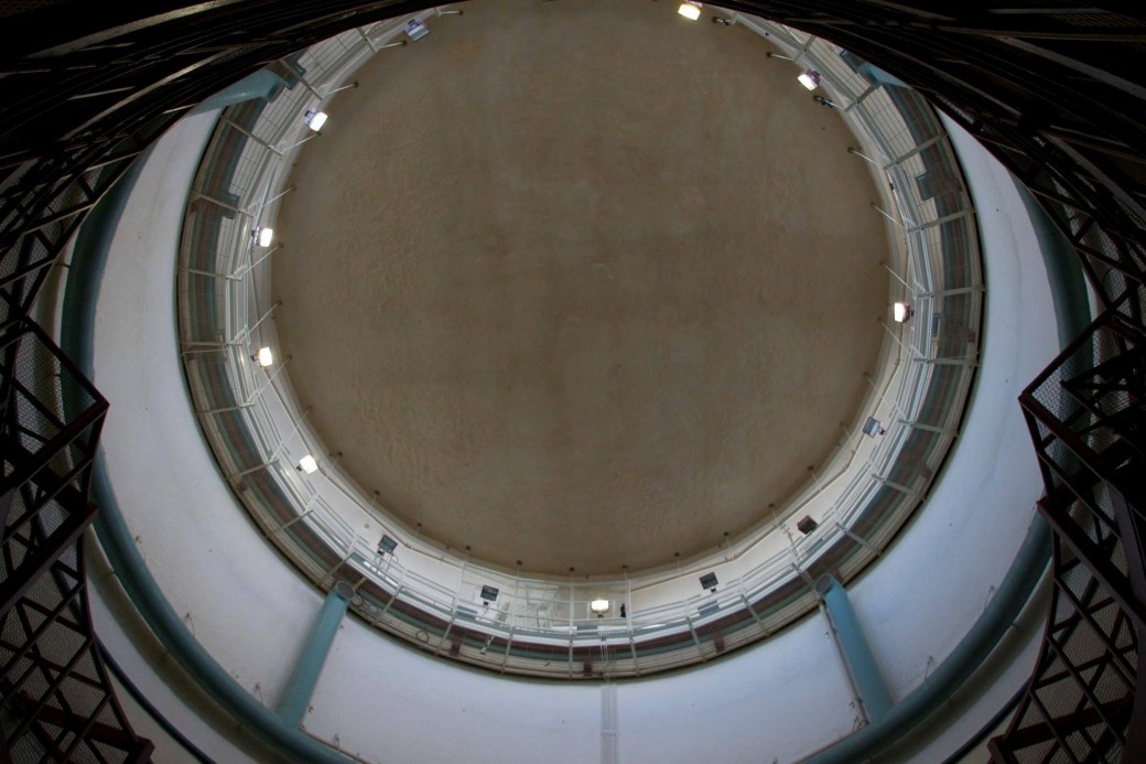
Image 1: The new Canada Science and Technology Museum (Photo courtesy of the Canada Science and Technology Museum)

A major output of our SSHRC Insight Development project is to reconstruct Bermuda’s climate using historical meteorological records from the 1840s to the present.  We are currently contextualizing the production of Bermuda’s historical climate data to create a better understanding of cultures and climates past and present.  Bermuda’s climate records reflect the different colonial projects that shaped the islands, which involved the British military and navy, trans-Atlantic trade, the US army and navy, and the tourism industry.

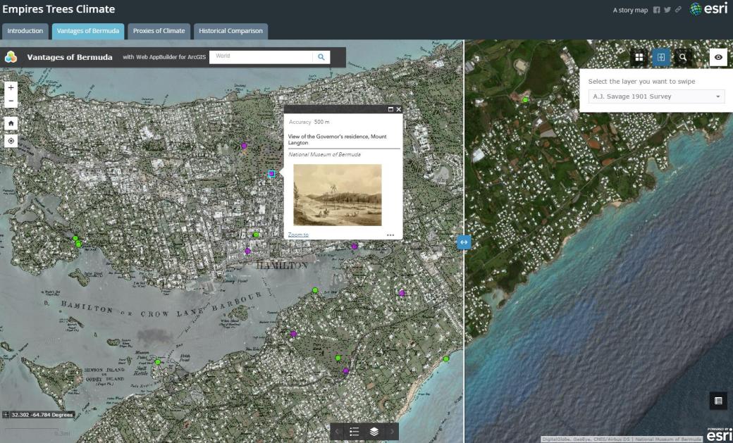
As the map illustrates below, Bermuda’s climate data were collected at different meteorological stations across Bermuda, which have their own histories for recording climate.  Some of these colonial histories reveal networks of meteorological science that connected Bermuda and Canada in the nineteenth and early twentieth century.

2

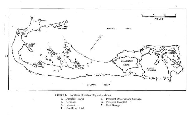
Figure 2: A map of the historical locations of the meteorological stations in Bermuda from W.A. Macky’s report on the Meteorological Station No.4, Bermuda Temperatures (1948)

This past year, we visited the Canada Science and Technology Museum in Ottawa to establish a new partnership, and to do conduct research on some of the individuals and instruments involved in Bermuda’s climate records. We hope to highlight some of these connections in conjunction with the museum’s new opening last week.

3

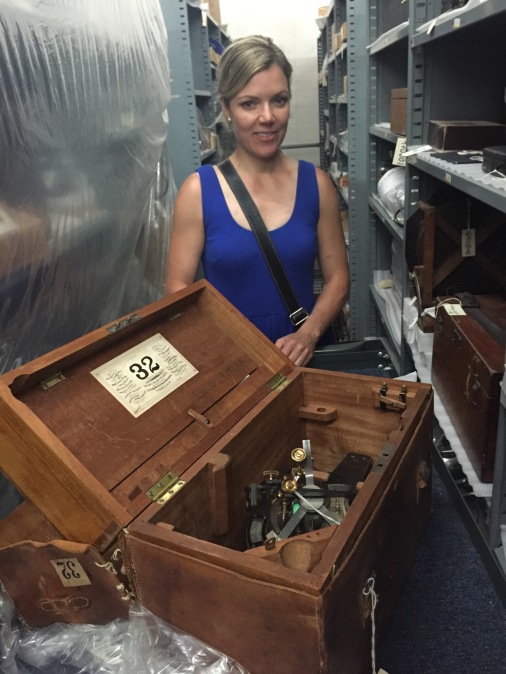
Figure 3: Kirsten Greer at the Canada Museum of Science and Technology during her first visit on 22 June 2017.  She is looking at a 1870s solar compass CSTM artifact #1968.0932 (Photo taken by William Knight).

Key figures include Sir William Reid (1791-1858), whose professional experience expanded a large breadth of natural earth systems science, is known for his hurricane research. He was appointed governor to Bermuda and focused his meteorological knowledge to improve irrigation, fertilization, and crop yields. Sir John Henry Lefroy (1817-1890), known as the traveling Canadian meteorologist, who specialized in Earth’s Magnetism was also appointed Governor of Bermuda. During his time there, he wrote the most detailed history of Bermuda’s earliest colonial years, which included information on climate and the islands natural history. James Patterson (1872- 1956), who shaped Canadian meteorology and meteorological equipment in Canada, influenced weather monitoring after World War II for Canadian and Bermuda aviation. As these figures reveal, Bermuda’s meteorological past is closely linked to Canada.

A special thank you to William Knight and David Pantalony of the Canada Science and Technology Museum for showing us the instruments, teaching us how they worked, and allowing us to use the artifact images for this blog post.

HMS Challenger.jpg

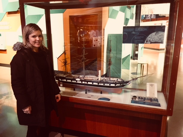
Figure 4: Kirsten Greer in front of a model of HMS Challenger (1872-1876), which was the first government funded global oceanic exploration through cooperation of the British Admiralty and the Royal Society.  HMS Challenger travelled between Bermuda and Halifax, Nova Scotia, collecting natural history specimens and ocean sediments.  The HMS Challenger model is part of “Artifact Alley” in the new Canada Science and Technology Museum (Photo taken by Will Knight 27 November 2017)

Sir William Reid (1791-1858)

Sir William Reid was born in 1791 in Manse, Kinglassie, Fifeshire in Scotland.  His early education was acquired through a private school in Musselburgh and later through the Edinburgh Academy. In 1807 he entered the Royal Military Academy at Woolwich.  By the age of 19 he was appointed to First Lieutenant of the Royal Engineers.  He was the Governor of Bermuda (1839-46), of the British Windward Islands (1846-48), and of Malta (1851-58).  He pioneered hurricane research based on his experiences in the West Indies and Bermuda.

4

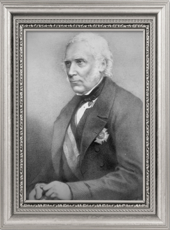
Figure 5: Sir William Reid (Photo from the NOAA Atlantic Oceanographic and Meteorological Laboratory)

Hurricanes:

Through Reid’s stationary travels he became a jack-of-all-trades and had an understanding of a variety of fields including chemistry, geology, botany and meteorology. His first contributions to the Professional Papers of the Corps of Royal Engineers were in 1838. His papers were titled “Further observation on the moving of the shingle of the beach along the coast” and “On Hurricanes”.

On August 10th, 1831 an extreme hurricane struck the island of Barbados.  High winds and 17-foot waves surged the island, demolishing buildings, sinking ships and killing close to 1500 people.  Lt. Reid who was part of the Royal Engineers was dispatched to Barbados to assist in the clean-up operation.  When he returned to England in 1834 he began developing a hurricane research project. He started to collect storm data from log books of British ships and assembled the information.  In 1838 he published “An Attempt to Develop the Law of Storms”. Due to his significant scientific contributions Reid was made a Knight Companion of the Order of the Bath in 1838. The following year he was elected a Fellow of the Royal Society.

Links to Bermuda:

Lieutenant-Colonel William Reid was appointed governor of Bermuda in 1838.  He assisted with agriculture development, as Bermuda was climatologically capable of producing early vegetable crops.  He advocated irrigation, and fertilization to improve crop yields.

References:

Baigent, Elizabeth. “Reid, Sir William,” Oxford Dictionary of National Biography

Blouet, Mary Olwyn.  “Sir William Reid., F.R.S, 1791-1858: Governor of Bermuda, Barbados and Malta,” Notes and Records of the Royal Society of London 40, 2 (May, 1986): 169-191

Naylor, Simon. “Log Books and the Law of Storms: Maritime Meteorology and the British Admiralty in the Nineteenth Century,” Isis 106, no. 4 (December 2015): 771-797

NOAA Atlantic Oceanographic and Meteorological Laboratory.  Hurricane Research Division. 185th Anniversary of the Great Barbados Hurricane (2016)


Sir John Henry Lefroy (1817-1890)

Sir John Henry Lefroy was born in 1817 in Ashe Hampshire, England. He obtained an early education in a private school. He then entered the Royal Military Academy in Woolwich, 1831.  In 1837, he had a posting for three months in Chatham to study practical astronomy at the Royal Engineers Establishment.  He is distinguished in the study of Earth’s magnetism.  Some of Lefroy’s published works include books on Magnetism, Barometric Pressure, the Aurora Borealis, Lunar Influence and magnetic surveys.  Lefroy was appointed Governor of Bermuda from 1871 to 1877 and was know for encouraging more trade and commercial links between Bermuda and Canada. He also has the most detailed history of Bermuda’s earliest colonial years ever written.

5

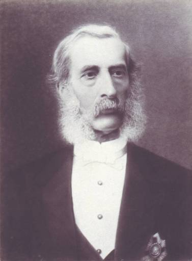
Figure 6: Sir John Henry Lefroy (Photograph by J.W. Beattie published in his book entitled “The Governors of Tasmania: from 1804 to 1896”, Hobart, 1896, Courtesy of Wikimedia Commons)

6

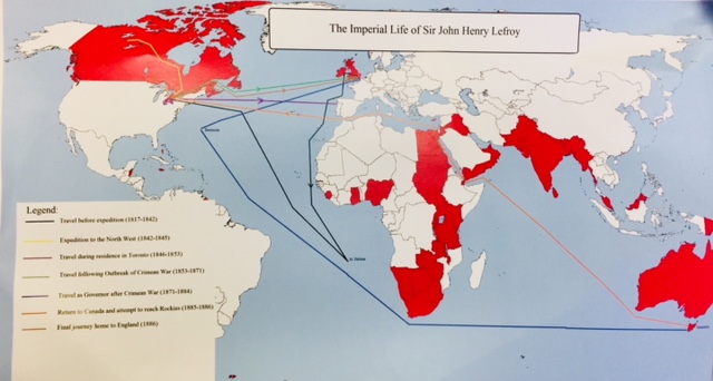
Figure 7: A map of the life-geography of John Henry Lefroy produced by Jake Shulman for Kirsten Greer’s HIST 3276 Empire and Environment course at Nipissing University.

Colonial Observations:

In 1839 the British government created a network of colonial observatories under the supervision of Edward Sabine. Lefroy was one of the first officers chosen for observatories planned for Upper Canada and the Cape of Good Hope. Henry was later chosen to set up and supervise an observatory on Saint Helena.

Terrestrial Magnetism:

In 1842, Lefroy was sent to Toronto as the superintendent of the new Toronto Magnetic and Meteorological Observatory.  He started planning a expedition to the northwest to ascertain the geomagnetic characteristics of British North America. He also wanted to attempt to locate the North Pole. Henry left Lachine, Canada East on May 1st 1843 for his expedition.  The expedition was 5,000 mile trek 18 months long and observed over 300 stations. He established himself as a geographer and eminent meteorologist.

References:

Goodman, Matthew. “Scientific Instruments on the move in the North American Magnetic Survey, 1843-1844,” Scientia Canadensis 39, 1 (2016-2017): 1–26

Thompson, Andrew. Sir Henry Lefroy 1817-1890. Biographies of the early Directors of Atmospheric Environment Service.

Whitfield, Carol M. and Richard A. Jarrell, “LEFROY, Sir JOHN HENRY,” in Dictionary of Canadian Biography, vol. 11, University of Toronto/Université Laval, 2003–, accessed November 30, 2017,


John Patterson 1872-1956

John Patterson is an influential figure in Canadian meteorology with ties to Bermuda and meteorological data collection.  John was responsible for bringing the original prospect records from Bermuda to the Canadian Meteorological Office in Canada.  He was born in 1872 in Oxford County Ontario and brought up on a rural farm.  He attended the Collegiate institute at Ingersoll and Woodstock. He later attended the School of Practical Science at the University of Toronto in 1896 and obtained a B.A. He obtained his M.A from Cambridge University.

He taught physics in 1903 at the University of Allahabad in India. He was first appointed to Imperial Meteorologist to the Government of India in 1905.  His interests in the field were how to improve cyclone warning and public weather forecasts.  When the great India earthquake happened in 1905, it led to the creation of a seismograph (an instrument used to detect and record seismic events). He later returned to Canada to proceed in his newly appointed position of Metrological Physics at the Meteorological Service of Canada.

7

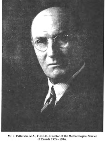
Figure 8: John Patterson (Photo from Thompson, Andrew. “John Patterson M.A F.R.S.C. 1872-1566.” Biographies of the early Directors of Atmospheric Environment Service)

Meteorological Instrumentation:

In 1917 John Patterson took part in the design and operation of the experimental helium extraction plants, which was sponsored by the British Admiralty’s Board of Invention and Research to obtain helium from natural gas. This was successful by 1919. Other influences on meteorological instrumentation include: the Meteorograph, the Canadian pilot-balloon program, the three cup anemometer, barometer and the electromagnetic anemograph.  His first project was an upper air meteorograph that was used with kites and balloons. This instrumentation observed temperature and pressure on a brass strip during flight.

A meteorograph is a device that has the ability to record several meteorological phenomena at the same time (ie. Barometric pressure and temperature). Figure 4; shows a meteorograph circa 1899. This led John Patterson to the establishment of an upper air meteorograph for use with kites and balloons use for aviation.

8

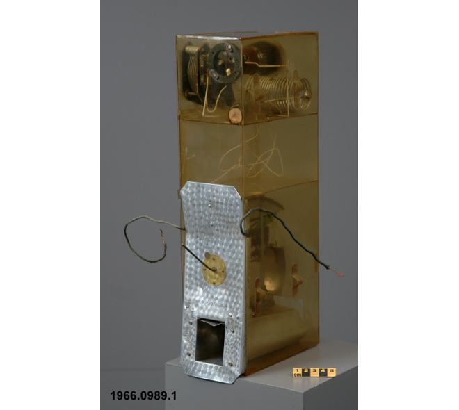
Figure 9: A meteorograph CSTM artifact #1966.0989 (Photo Courtesy of the Canada Museum of Science and Technology)

The Canadian pilot- balloon program was initiated to understand the velocity of upper winds from flight observations.  This links Patterson with Canadian aviation.

The meteorograph shown above is directly related to Patterson, which he used as a device raised by balloon into the upper atmosphere to read atmospheric pressure and temperature. These readings were expressed by flashing lights attached to the balloon, which could be seen by observers on the ground.

Another meteorograph connected to Patterson at the Canada Museum of Science and Technology is the one below.  This instrument was used at one of Canada’s four international polar year stations, which was organized by the international meteorological conference of directors in 1929 to commemorate 50th anniversary of polar year 1882-83. The objective was to establish as many stations as possible in polar regions.

9

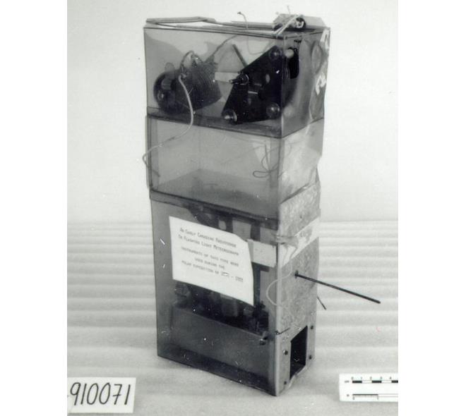
Figure 10: A meteorograph CSTM artifact #1991.0071 (Photo Courtesy of Canada Museum of Science and Technology)

Barometer:

A barometer is mercury-filled instrument that records the barometric pressure of the atmosphere. In the 1930’s Patterson modified the barometer otherwise known as the Kew-Patterson barometer making the instrument easier to read and safer for travel. Until 35 years ago. 75 percent of the mercury barometers shipped to Canada arrived broken. Shortly after WW1, designed a barometer for manufacture in Canada Patterson combined the advantages of a Kew Barometer with the portability of the Fortin Barometer. It could be shipped to any weather station in Canada with little risk of breaking. Now there is an automatic procedure for filling barometer tubes with pure mercury  (a method still used today) in which boiling of mercury is eliminated and there is no danger of breaking the tube.

10

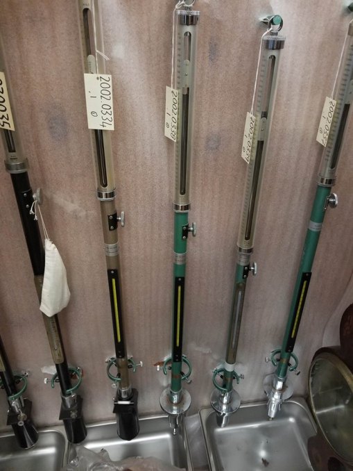
Figure 11: Patterson’s Barometers at the Canada Science and Technology Museum (Photo Courtesy of Laurel Muldoon 6 July 2017)

 11

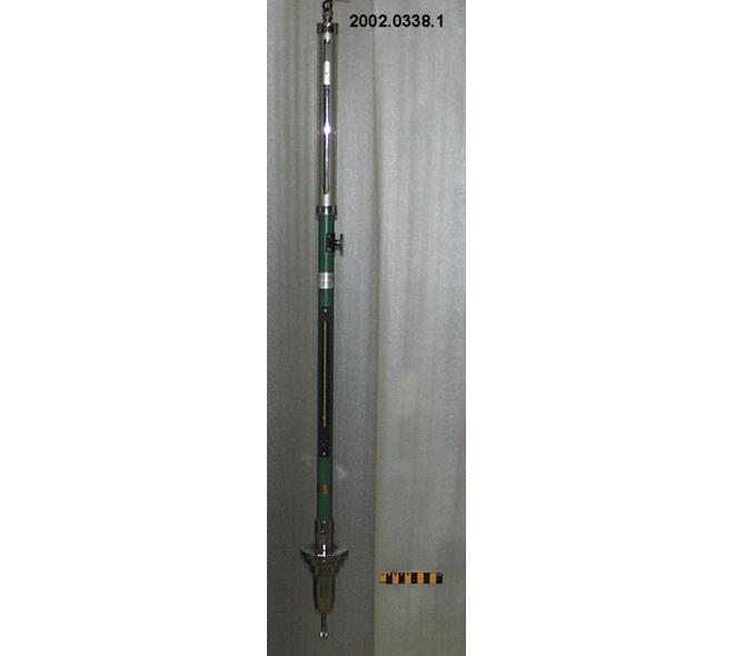
Figure 12: A Barometer CSTM artifact #2002.0338.001 (Photo Courtesy of the Canada Science and Technology Museum)

Three Cup Anemometer:

The Canadian Meteorological Service used the first anemovanes in 1870. The original four cup anemometer was developed by Robinson of Ireland in 1846. By 1870s there were two wind measuring devices that were developed by Dr. George Kingston (Director of the Canadian Meteorological Service) and father of Canadian Meteorology. The four-cup anemometer and anemograph were used until the 1900’s. Patterson developed a three-cup anemovane in 1930.

Patterson’s model:

  • Patterson carried out extensive experiments in wind tunnels of the National Research Council of Canada in Ottawa and the University of Toronto
  • He tested cup shape, length of cup arms and number of cups
  • Three cups were more accurate then the original four cup
  • In 1930 he surpassed the original aneovanes and the Canadian Meterological Service used his model for almost three decades

How it works:

  • The three cup anemovane and a single-vane windvane on a double shaft would send readings electronically to an anemograph
  • Wind seed was measured my means of the three-cup cupwheel which when turned by the shaft as the lower end acted like a wheel spinning on a pin
  • The wheel was calibrated to make one revolution per mile of wind
  • When the pin made contact with the spring in the mechanism, the circuit through the anemograph was closed
  • The anemograph would then register the mark on the chart

12

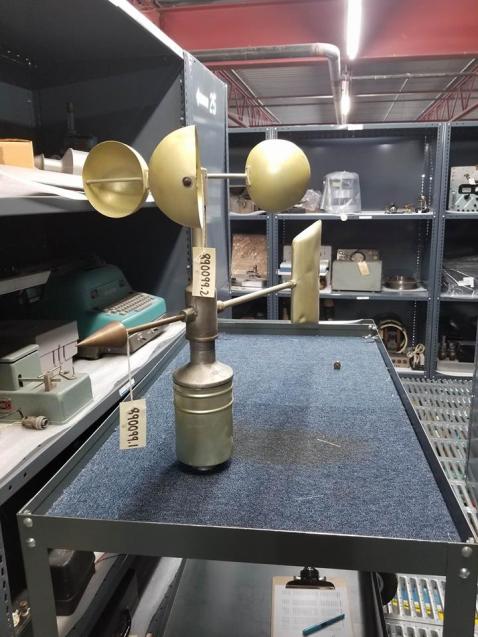
Figure 13: Three-cup amneovane. CSTM artifact #1989.0099 (Photo courtesy of Laurel Muldoon 6 July 2017)

Electromagnetic Anemograph:

This device records wind velocity and direction data that is received from a separate anemometer and wind vane. Values are recorded by perforating a paper chart.  Original method or recording was don with pen and ink.  Original casing would have been made out of wood.

13

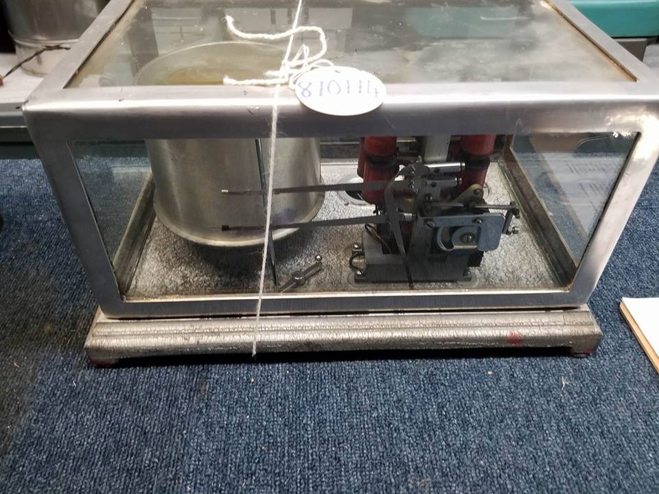
Figure 14: Electromagnetic Anemograph. CSTM artifact #1987.0774 (Photo courtesy of Laurel Muldoon 6 July 2017)

The Canadian Meteorological Service:

John was appointed Assistant Director of the Canadian Meteorological Service in 1924 and Director in 1929. His responsibilities included modernizing the service and encouraging interdisciplinary communications between different branches of meteorology.  This was to insure that all departments were up to date on the latest developments. Furthermore, he was responsible for organizing meteorological services for the Trans-Canada Air Lines and for the Canadian division of Trans-Atlantic Aviation. During WWII, Patterson was also responsible for providing weather services to the Royal Canadian Air Force. He retired in 1947.

References:

Canadian Science and Technology Museum Corporation.  2017. Meteorograph. https://ingeniumcanada.org/ingenium/collection-research/collection-item.php?id=1966.0989.001.

Patterson J, Brookes R.C. 1994. John Patterson’s Meteorological Instruments. Bulleting of the Scientific Intrusment Society. 40.

Thompson, Andrew. “John Patterson M.A F.R.S.C. 1872-1566.” Biographies of the early Directors of Atmospheric Environment Service.

Pictures: Taken by Laurel A Muldoon at the Museum of Science and Technology in Ottawa, Ontario.


Visiting the Canada Science and Technology Museum

By: Laurel Muldoon (MESc graduate student, Nipissing University)

Part of an interdisciplinary project is stepping outside a research comfort zone. As a Master’s of environmental Science candidate at Nipissing University I have studied mainly physical geography. Ask me how to navigate around a stable isotope mass spectrometer lab is an easy question. However, navigating through historical archives and artifact collections is a different experience. Dr. Kirsten Greer and I set out to Ottawa to meet with curator William Knight at the Canada Museum of Science and Technology in Ottawa this summer. The moment William let us into the collections warehouse, I knew I would be hooked. After spending much of the summer researching meteorological equipment and key figures to Canadian and Bermuda Meteorological history, it was incredible to look at the instrumentation up close.  You can see our enthusiasm as we take out old archives and examine them. I had the opportunity to show William and Kirsten how the meteorological instrumentation worked. It is not every day that the student gets to teach the instructor. Many of the photos used in the blog post come from the museum’s meteorological collection in Ottawa. The day of research went by too quickly. I want to give a huge thank you to William Knight and the Museum of Science and Technology.

I am looking forward to another visit to the collections and archives and to see the new museum.

14

Figure 15: William Knight and Laurel Muldoon looking at meteorological equipment instruction manuals (Photo courtesy of Kirsten Greer 6 July 2017)

15

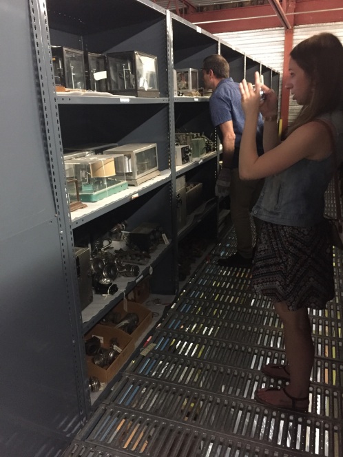
Figure 16: Laurel Muldoon taking photographs of electromagnetic anemographs in the collection (Photo courtesy of Kirsten Greer 6 July 2017).

16

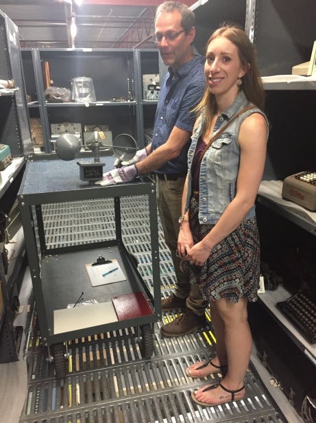
Figure 17: William Knight and Laurel Muldoon researching three-cup anemometers (Photo courtesy of Kirsten Greer 6 July 2017)

Historical Geography Specialty Group Student Awards 2016-2017

The Association of American Geographers Historical Geography Specialty Group

2016-2017 STUDENT AWARDS

HGSG STUDENT RESEARCH AWARD

Student members of the Historical Geography Specialty Group (HGSG) are invited to submit proposals for the HGSG Student Research Award. The specialty group will grant two prizes in 2017. The awards will be $400 for the Carville Earle Award recognizing research at the Ph.D. level, and $200 for the Terry G. Jordan-Bychkov Award supporting Master’s level research. Students can win each award only once.

Students seeking funds to underwrite thesis or dissertation research should submit a two-page summary of their proposed research on a topic in historical geography. The statement should spell out the research question and how archival and/or field work is necessary to complete the project, and specify the archives collection and/or field research site to be utilized. The award may be used to cover travel and related research expenses. In addition to the two-page summary, applicants should include a short budget of estimated expenses. The student’s major advisor must also submit a letter of support to the committee’s chair that verifies the student is making progress toward conducting their research. A two-page report will be required upon completion of the funded portion of the project and will be published in Past Place.

Please submit your two-page proposal with budget via e-mail by Monday, March 15th, 2017, to Dr. Declan Cullen, George Washington University  drcullen@gwu.edu 
HGSG STUDENT PAPER AWARD COMPETITION — CALL FOR PAPERS 

The Historical Geography Specialty Group (HGSG) of the AAG will sponsor two student paper award competitions in 2016-2017:

Ralph Brown Award – for papers written by Master’s-level students, and Andrew Hill Clark Award – for papers written at the Ph.D. level.

Each award carries with it a $150 first prize.  Second prizes of lesser amounts may be awarded at the discretion of the competition judges.  In evaluating the papers, preference will be given to those based on primary sources of information rather than literature reviews.

Eligibility Notes:

Eligibility for the awards is open to any graduate student who has or will present a paper at any professional conference beginning the day after the 2016 AAG Annual Meeting and ending the last day of the 2017 Annual Meeting. If the paper you wish to enter for the Ralph Brown award is based upon research conducted while you were a Master’s student, you are eligible to enter this competition even if you are now a Ph.D. student.  Students who have already won a Ralph Brown Award or Andrew Hill Clark Award in the past are NOT eligible to submit for the same award again. (Previous winners of a Ralph Brown Award, however, are eligible to submit for the Andrew Hill Clark Award.)

Submission Procedure:

Students wishing to participate should send copies of a conference-length paper of no more than 11 double-spaced pages (plus notes, figures, etc.) to each of the committee members listed below.  Papers should be sent by e-mail in MS Word or PDF format.  Please specify in your email [1] the name of the award for which you are applying, [2] the graduate program in which you are enrolled, and [3] the conference at which your paper was (or will be) presented. The deadline for receiving materials is April 1, 2017. Please submit to, Dr. Samuel Otterstrom, Department of Geography, Brigham Young University, Sam_otterstrom@byu.edu,  and Dr. Matthew Fockler. Augustana College,matthewfockler@augustana.edu.

All questions should be directed to the members of the Paper Awards Committee above.


CRC IN GLOBAL ENVIRONMENTAL HISTORIES AND GEOGRAPHIES AWARD

Student members of the Historical Geography Specialty Group (HGSG) are invited to submit proposals for the Canada Research Chair in Global Environmental Histories and Geographies Award. The specialty group will grant two prizes in 2017. The awards will be $700 for research at the Ph.D. level and $300 for supporting Master’s level research. Students can win each award only once.

Students seeking funds to underwrite thesis or dissertation research should submit a two-page summary of their proposed research on a topic that touches on the geographical tradition of environmental history, which can include the Berkeley tradition, historical geographies of science, spatial histories, HGIS, landscape change over time, and/or human-environment relations in the past.  The statement should spell out the research question and how archival and/or field work is necessary to complete the project, and specify the archives collection and/or field research site to be utilized. The award may be used to cover travel and related research expenses. In addition to the two-page summary, applicants should include a short budget of estimated expenses. The student’s major advisor must also submit a letter of support to the committee’s chair that verifies the student is making progress toward conducting their research. A two-page report will be required upon completion of the funded portion of the project and will be published in Past Place.

All questions should be directed to the Paper Awards Committee Chair by Monday, March 15th to Dr. Kirsten Greer, Assistant Professor in Geography & History Nipissing University, Ontario, Canada kirsteng@nipissingu.ca   Award Committee Members include: Dr. Kirsten Greer, Dr. Jamie Murton (History, Nipissing University), and Dr. Arn Keeling (Geography, Memorial University).

Research Profile #4: Katie Hemsworth, Cultural Geographer

This month’s researcher profile features Dr. Katie Hemsworth (PhD, Queen’s University; MA & BA, Brock University). To see the first three posts in this series, click  here for Dr. Adam Csank (dendrochronologist), here for Dr. Kirby Calvert (energy geographer), and here for Dr. Kimberly Monk (maritime archaeologist).

What is your specialization?

I am a cultural geographer with a rather odd array of specializations: sonic geographies (sound as a way of knowing and organizing our world); carceral geographies (incarceration, institutionalization, and confinement); emotional geographies (place-making as a deeply emotional practice); and qualitative and arts-based methodologies (research as a social practice; arts-based methods and outlets).

My PhD research (see Hemsworth 2015, 2016) was on the sonic geographies of prisons, which explored how people experience prisons as acoustic and auditory environments. I was particularly interested in the use of sound-based techniques to re-shape space, time, and power relations in confined spaces. Through this work, I began to experiment with sonic and arts-based methods as ways of communicating geographical knowledge. I came to appreciate how sonic methods might be particularly useful for interdisciplinary research, where there is often a need to move beyond the visual and the linguistic.

kingston-pen-main-dome

Katie Hemsworth’s PhD research explored cultural and historical soundscapes of prisons and advocated for deep listening as a way of understanding past and present environments. The main dome at Kingston Penitentiary in Kingston, Ontario, is an example of the role of architecture in shaping a sonic environment. In this case, the dome created both a sense of ‘godly’ omnipresence while also intensifying feelings of disorientation, as overlapping sounds would reverberate and swirl throughout the cavernous limestone building. (Photo by Ryan Benvenuti)

Why are you interested in the project?

Before I moved from Canada to the US, a friend handed me a small carving he made from a knot of wood and said, “wherever you go, look for the trees; they’re some of the best storytellers you’ll ever meet.” I’m interested in this project because it recognizes, through examining the historic timber trade, that everything has a story. There are many tellers – from trees to local residents to binary codes – and many ways of telling. I like that this project explores storytelling through dendro-provenancing, archives, maps, or songs.

kh-tree-gifford-2015

Katie Hemsworth, listening for the stories of the trees where her Scottish ancestors lived (Gifford, UK, 2015; photo by Callie Hemsworth)

I’m very much drawn to the interdisciplinary contributions (and challenges!) this project poses. It is rare to see researchers from such disparate fields working together on questions that span scientific, cultural, historical, environmental and political investigations of a particular phenomenon or place. I had been following the blog for some time as an interested colleague, but when I attended the special session put together by the Empire, Trees & Climate group at the Canadian Association of Geographers Meeting in Halifax (May 2016), I was impressed by the very critical questions posed by the group about interdisciplinary research, including: what is a research site, and what constitutes a research sample? What is an archive? What are the ethical dilemmas and contradictions posed by interdisciplinary and multi-species research?

Finally, having been born and raised in Thunder Bay, Ontario, I’m excited to contribute to projects that highlight rich research programs in Northern Ontario. I appreciate that this project draws connections between diverse places like Nipissing District, Dokis First Nation Reserve, Atlantic Canada, the Caribbean, and the UK.

What will you contribute to the team?

I hope to expand Lave et al.’s (2014) notion of ‘social-biophysical landscape’ to include soundscape. Part of this will also include re-thinking A.E. Douglass’s (1920) conceptualization of ‘talkative trees’ to think about what trees (and related timber and timber extraction processes) sounded like.  At the moment, I have three key goals:

  1. I am helping build a sound archive of historical sounds in Bermuda (for example, calls of birds that are now endangered or extinct). This archive will be shared on the ETC blog, but it will also be incorporated into our GIS storymap prototype for a more interactive experience. Similar to Megan Prescott’s work using visibility analysis, I hope to eventually tell a more nuanced story about the audibility of British imperial trade and colonial expansion in the Caribbean and Canadian contexts. Drawing on initial work being done by Nipissing MESc student, Laurel Muldoon, I am also interested in the disappearance of the Bermuda cicada and the Eastern bluebird, as two key “soundmarks” that would have been central aspects of Bermuda’s soundscape in the past, but are no longer heard today. I am fascinated by the use of existing bird call recordings to repopulate (and often relocate) an endangered species, as was done for the Bermuda petrel, and wish to better understand the potential of such sonic methods for conservation efforts as well as their accompanying ethical questions.
  1. I’m working on a manuscript (that is quickly becoming multiple manuscripts… we’ll see!) on the conch shell as a material and sonic remnant of historical relations of power. This includes the conch’s role in the sonic organization of labour (blowing the shell at particular times to signal specific commands), as well as its presence in music and as a tourist trinket that ended up in Canadian homes. Thanks to work already done by Margot Maddison-MacFadyen, I am trying to connect this with the use of oil barrels left on Bermudan beaches by the British Navy after WWII and later used as musical instruments. The interest in the conch shell has blossomed into a much larger project about the utility of sonic methods for historical research, so please stay tuned for additional manuscripts and presentations.
  1. Finally, as one of the cultural geographers on the team, I am here to help with conceptualizing scientific research as a socio-cultural process. One example of this is drawing on my research on emotion and embodiment to further develop the notion of ’embodied energies.’ Another is to think critically about the ethical challenges posed by interdisciplinary and multi-institutional research. One possibility is to evaluate the ethics of using audio recordings (of endangered birds, for instance) in conservation efforts to reconstruct avian soundscapes of places like Bermuda.
dscn5713

Adam Csank speaking with David Wingate (right) during a research trip to Bermuda in 2015. In 1951, at only 15 years of age, Wingate was part of a team that learned the Bermuda petrel (Pterodroma cahow) was not extinct, as had been assumed for centuries. He dedicated much of his life to conserving the Bermuda petrel (or “cahow”) population, most notably on Nonsuch Island. For more information, see E. Gehrman’s book, Rare Birds: The Extraordinary Tale of the Bermuda Petrel and the Man Who Brought It Back from Extinction (2012) and Lucinda Spurling’s film, Rare Bird (2006). (Photo by Kirsten Greer).

What are you hoping to find out?

I’m eager to find out more about the connections between the timber trade, climate change, and soundscape. In other words, what kind of influence did the British timber trade have on the climate of places like Bermuda and northern Ontario, and how can this be heard in past and present soundscapes? My work recognizes that it’s not just the objects (like the conch or oil barrel) that signal cross-cultural relations through processes like colonization, but also the sounds themselves. Although sounds can be fleeting, they can travel long distances and trigger powerful memories of the past. I hope to learn more about these lingering remnants of historical relationships, conditions, and flows.

What do you think will surprise you?

How little I actually know about trees!

Why do you love your work?

I love asking questions about the role of space, place, and time in our everyday lives, and I get to do that all the time as a geographer. The Empire, Trees, and Climate project allows me to fulfill that interest in so many ways: from thinking about acoustic ecologies, to considering different understandings of time through dendrochronology and music, to anticipating the embodied effects of climate change on individuals and their communities. I love that this research allows me to work with historians, dendrochronologists, philosophers, and GIS-technicians, and that we all share a passion for thinking critically about environmental change.

 References

Douglass, A.E. 1920. Evidence of climatic effects in the annual rings of trees. Ecology 1(1): 24-32.

Gehrman, E. 2012. Rare Birds: The Extraordinary Tale of the Bermuda Petrel and the Man Who Brought It Back from Extinction. Boston: Beacon Press.

Hemsworth, K. 2015. Carceral acoustemologies: Historical geographies of sound in a Canadian prison. In Moran, D. and Morin, K. (eds.), Carceral space and the usable past: Historical geographies of prisons and jails. London: Routledge, pp. 17-33.

Hemsworth, K. 2016. “Feeling the range”: Emotional geographies of sound in Canadian prisons. Emotion, Space & Society, 20: 90-97.

Lave, R. et al. 2014. Intervention: Critical physical geography. The Canadian Geographer, 58(1): 1-10.

Spurling, L. (Director). 2006. Rare Bird. Bermuda: Afflare Films.

CFP – Canada at 150: Critical Historical Geographies

Canada at 150: Critical Historical Geographies

CAG 2017 CFP

 The 150th anniversary of the Canadian state is an ideal opportunity to consider the state of ‘Canada’ as a subject for historical geography and historical geographers.

 Almost a quarter-century has passed since the publication of the last volume of the Historical Atlas of Canada, and the contributors to that massive project are now senior scholars; others have retired or passed away. Multiple generations of their students, along with additional practitioners, are now producing new historical geographies, incorporating more source materials, methods, positions, subjects, and interdisciplinary connections – including, importantly, deeper affiliations with Indigenous Studies. Some of this work, including the stirrings of a revised Historical Atlas, pays close attention to digital technologies for the collection, assessment, and presentation of historical geographies.

 The 2017 CAG meeting, held alongside the Congress of the Humanities and Social Sciences in Toronto, is therefore an opportunity to consider changes and contiguities since the era of the Historical Atlas, and in a moment of swelling nationalism, to discuss ways of writing and making critical historical geographies of Canada.

 We propose a set of thematic panels at which 4-5 speakers will present 10-minute ‘position’ statements, drawing on specific research expertise and interests but with an eye to broader conversations, followed by discussion across the panel and with the audience. We will aim to publish a collection of these statements shortly after the conference.

 These sessions will be submitted as ‘roundtables’; participants should still have an opportunity to present conventional papers in other sessions.

 Potential (overlapping) themes might include:

·      Digital historical geographies, and other ‘new’ methodologies

·      Historical geographies of extraction and environment

·      Historical geographies of nationalism and ‘nation-building’

·      Indigenous historical geographies

·      New urban historical geographies

·      Training and teaching in historical geography

 Please send expressions of interest, including a brief summary abstract, to farish@geog.utoronto.ca by February 3, 2017.

 Organizers (under the auspices of the CAG’s Historical Geography Specialty Group):


Matthew Farish, University of Toronto

Kirsten Greer, Nipissing University

Arn Keeling, Memorial University

Phillip Mackintosh, Brock University

The Environmental Humanities: Contributions from Northeastern Ontario

Please join our MES/MESc seminar series at Nipissing University to discuss interdisciplinary research on the environment with Dr. Brett Buchanan, Director of the School of Environment and Associate Professor philosophy at Laurentian University, Sudbury.

Thursday, December 8th, 7pm in the Small Cafeteria, Nipissing University

The Environmental Humanities: Contributions from Northeastern Ontario

Scholars working across interdisciplinary boundaries are increasingly working together to think through and experiment with the complicated entanglements of our natural worlds. Different modes of knowing, understanding, and relating to others in our multispecies worlds are being explored, including the rise of human-animal studies, new ethnographic collaborations, and ethics in a time of uncertainty. In this talk I’ll discuss some of the theoretical and historical background to the environmental humanities along with my research projects on philosophical ethology, environmental consequences of Sudbury’s land remediation, and the continued (and fraught) urban presence of black bears.

IMG_6020(1).JPG

Blog #12: Empowering HGIS Research at ESRI Canada User Conference October 2016

Megan Prescott, GIS Technician for the CRC in Global Environmental Histories & Geographies, Nipissing University, Ontario

1

Figure 1. Approaching the Toronto Congress Centre, venue of the 2016 ESRI Canada User Conference.

As the GIS technician within Empires Trees Climate, I was sent to the 2016 ESRI Canada User Conference in Toronto October 5th, 2016 with the prospect of absorbing information that would lend itself to our online mapping application and other HGIS projects.  The conference had just less than 1100 in attendance, with different user sessions targeting areas such as resources, health, education, engineering, government and commercial uses.

While none of the overarching sessions were targeted specifically towards historical applications, they did explore tools that lend themselves well to historical research projects. One major driver for attending was a session on ArcGIS Online Story Maps, which is the platform through which we have chosen to showcase historical spatial data relevant to the Critical Dendro-Provenancing of Empires Trees Climate.

2

Figure 2. A screenshot of the Empires Trees Climate prototype currently under development.

My conference sessions began with a presentation exploring the transition from traditional desktop-based GIS to its web alternative, something we have just recently begun moving towards.

3

Figure 3. A session on the benefits of implementing web GIS in your organization.

As a practice grounded in technology, GIS is a dynamic field of study that is constantly evolving. A transition towards online GIS is being seen in many organizations and across various disciplines.

Web GIS opens up users to a rich variety of additional applications not available through traditional desktop platforms. Highlights I have found include the Web App Builder, ESRI Story Maps, and the AppStudio, the former two of which are being used directly in our data-sharing prototype to disseminate our research to a general audience.

4

Figure 4. An example of a Story Map Series in the tabbed layout. The prototype for the Bermuda project follows a similar template.

Online application templates allow for easy publication and dissemination of data, if desired.  However, organizations wishing not to publish externally are also making the switch to online for several benefits:

  • Data housed online can remain private to an organization


  • Supplying members of your team with an organizational login ensures that everyone has access to the most current version of any one document, map, or dataset, and avoids the necessity of having to work through the team’s GIS technician to gain access to any one output


  • Data can be accessed both on and off site, a major benefit for team members who are taken into the field. Modern online GIS specifically supports data contributions and access from the field through apps such as Survey123


  • Logins can be used to ensure that data is still protected from accidental changes by limiting edit permissions to qualified personnel and restricting others to a view-only access

5

Figure 5. A session on the Story Map series of applications.  

As our primary interest is the Story Maps applications, I reviewed some tricks of the trade and best practices for Story Maps presentations, including suggestions for testing and embedding. It was a great introduction for new users, but also provided a few advanced tips I could insert into our prototype’s creation.

Space Time Cube Analysis for Historical Trend Analysis

One of the innovations that most caught my eye for historical GIS at the conference is Space Time Cube Analysis, coupled with Emerging Hot Spot Analysis. Space Time Cube Analysis is an add-in for ArcGIS Pro, a mapping software package offered through ESRI. Released only in July 2016, the tool is cutting edge and seems yet to find its solid place in the world of HGIS despite its promise (D’Acosta, 2016). In the conference session, Vancouver crime analysis was used as an example.

6

Figure 6. The Space Time Cube/Emerging Hot Spot Analysis example presented at the conference

Analysts can use these tools to see patterns over both time and space that would otherwise have taken several maps to visualize through the use of a four-dimensional cube, displaying the data of several time periods at once.

7

Figure 7. A diagram explaining the Space Time Cube (ESRI, 2016).

Each cube holds the data of a geographical area for a block of time. As shown above, one cube can hold several records of data (generally, multiple occurrences of what you are trying to see a trend in, such as instances of crime).

When taken out of 2-dimensional view, the output looks something like this:

8

Figure 8. The output of a Space Time Cube Analysis, where a stack or column may represent several years of data (D’Acosta, 2016). 

Moving from top to bottom through one stack of cubes displays how a factor has increased or decreased in that area overtime. The width of these stacks can be adjusted to a smaller size to allow the viewer to see the change in all stacks at one time.

Historical trend analysis can be further deepened from here using Emerging Hot Spot Analysis.

9

Figure 9. Recall the Space Time Cube/Emerging Hot Spot Analysis example presented at the conference

Following a legend (below), the colour of the area or polygon will describe the entire stack of data below it.

In other words, each polygon describes the trend in data for its area over months, years, or decades.

A colour or pattern may indicate an area as a historical hotspot where there is no longer activity, a persistent hotspot, a new hot spot, an intensifying cold spot, and more, allowing the analysis to find and display areas of interest to their research.

10

Figure 10. An Emerging Hotspot Analysis output legend, with an example (D’Acosta, 2016).  

The application of this tool for viewing historical trends in data is exciting, provided sufficient records and data appropriate to this analysis exist.

Some immediate applications for HGIS that came to mind were displaying trends in:

  • Historical populations of a wildlife species, using biodiversity data from specimen records, sightings in journals and in photographs
  • Regional drought/environmental stress, using dendrochronology data
  • Historical census data, such as population and the movement of languages and ethnicities

These were the sessions and presentations I found most promising for our research and for other potential historical GIS projects.  Thank you for your interest in our blog and I hope you’ve found something to consider for your own GIS projects.

References

D’Acosta, J. (2016, July 7). The Space Time Cube Explorer Add-in for ArcGIS Pro has been Released! ArcGIS Blog. Retrieved from: https://blogs.esri.com/esri/arcgis/2016/07/07/the-space-time-cube-explorer-add-in-for-arcgis-pro-has-been-released/

ESRI (2016). Create Space Time Cube [ Figure]. Retrieved from: https://pro.arcgis.com/en/pro-app/tool-reference/space-time-pattern-mining/create-space-time-cube.htm

Dr. Nathan Basiliko “Bioenergy production in Canada’s forestry sector: a soils perspective” 25 Oct 7pm

basiliko-nathan1

NIPISSING UNIVERSITY’S MES/MESc SEMINAR SERIES 2016-2017

Tuesday, 25 October 2016  7 -9 pm

Raven and Republic http://www.ravenandrepublic.ca/

246 1st Avenue West
North Bay

Dr. Nathan Basiliko, Canada Research Chair in Environmental Microbiology, Associate Professor at the Vale Living with Lakes Centre and the Department of Biology at Laurentian University, Sudbury, Ontario

“Bioenergy production in Canada’s forestry sector: a soils perspective”

Canada’s forestry sector collectively represents the largest industrial-scale producer of bioenergy nationally. There is interest in enhancing biomass energy production capacities to both reduce fossil fuel demands as well as build new markets for the forestry sector, which has faced challenges in the past 2 decades. Current best forest management practices in Canada are generally sustainable; however the costs and benefits of intensified biomass harvesting to supply additional feedstocks for bioenergy production are not clear. In particular, intensified harvesting effects on soil biota and associated carbon and nutrient cycling that are at the heart forest ecosystem functioning remain to be determined. Here I will present findings from collaborative research trials and interrelated student-led projects focused on ecosystem-level implications of bioenergy production in commercially managed Ontario forests. Two trials, one in boreal and the other in north-temperate (Great Lakes St. Lawrence) forests, have explored impacts of both business-as-usual harvesting and varying levels of intensified biomass harvesting. Additionally, trials near the same sites are examining the potential to return biomass boiler (wood ash) and pyrolysis (biochar) residues to soils with the intent of mitigating some of the potential negative impacts of intensified harvesting. The main emphasis of this presentation is on soil biotic (microbial communities and soil vertebrate indicator species) and biogeochemical responses to both intensified biomass removal practices as well as potential mitigation measures.

CFP AAG 2017 Boston

**Call For Papers**

 What does it mean to do interdisciplinary research on past environments? Exploring mixed methods in geography through the lens of critical physical geography.

 AAG, April 5-9 2017, Boston, MA

Organizers: Kirsten Greer (Nipissing University) Adam Csank  (University of Nevada), Kirby Calvert (University of Guelph), and Margot Maddison MacFadyen (Memorial University)

Discussants: Rebecca Lave (Indiana University) and Maria Lane (University of New Mexico).

What does it mean to be interdisciplinary and integrative in the geophysical sciences and humanities? Can a project be considered interdisciplinary if it only involves disciplines within the sciences or the humanities or does it need to cross those boundaries? To what extent, and how, can asymmetrical research improve interdisciplinary research projects? Through case studies, this session seeks to highlight how geographers are bridging the divide between human and physical geography and more generally between the sciences, social sciences and the humanities. The inspiration for this session proposal emerged from discussions and challenges experienced during field work in ‘critical dendrochronology’ to understand the role of the timber trade in the British Empire, involving historians, human geographers, an environmental scientist and an archaeologist. We have organized a group of papers that will highlighting some of the results of this project but we also welcome submissions on the topic of interdisciplinary studies that cross the boundary between the humanities, sciences and social sciences.  We are particularly interested in papers that involve collaborations between geophysical scientists and historical geographers/environmental historians.

This session is sponsored by the AAG Historical Geography Specialty Group.

We invite interested participants to send their title, 250-word abstract, and affiliation to Kirsten Greer (kirsteng@nipissingu.ca) by October 15, 2016. As this session has adiscussants, we will ask participants to circulate their papers several weeks prior to the conference.


See:

Lave, Rebecca, Matthew W. Wilson, Elizabeth Barron, Christine Biermann, Mark Carey, Martin Doyle, Chris Duvall, Leigh Johnson, Maria Lane, Jamie Lorimer, Nathan McClintock, Darla Munroe, Rachel Pain, James Proctor, Bruce Rhoads, Morgan M. Robertson, Jairus Rossi, Nathan F. Sayre, Gregory Simon, Marc Tadaki, and Christopher Van Dyke. 2014.”Critical physical geography.The Canadian Geographer 58(1): 1-10.